Wait a sec…”Part 3″? I thought the last Great Tintype Adventure of 2017 was “Part 1”?!
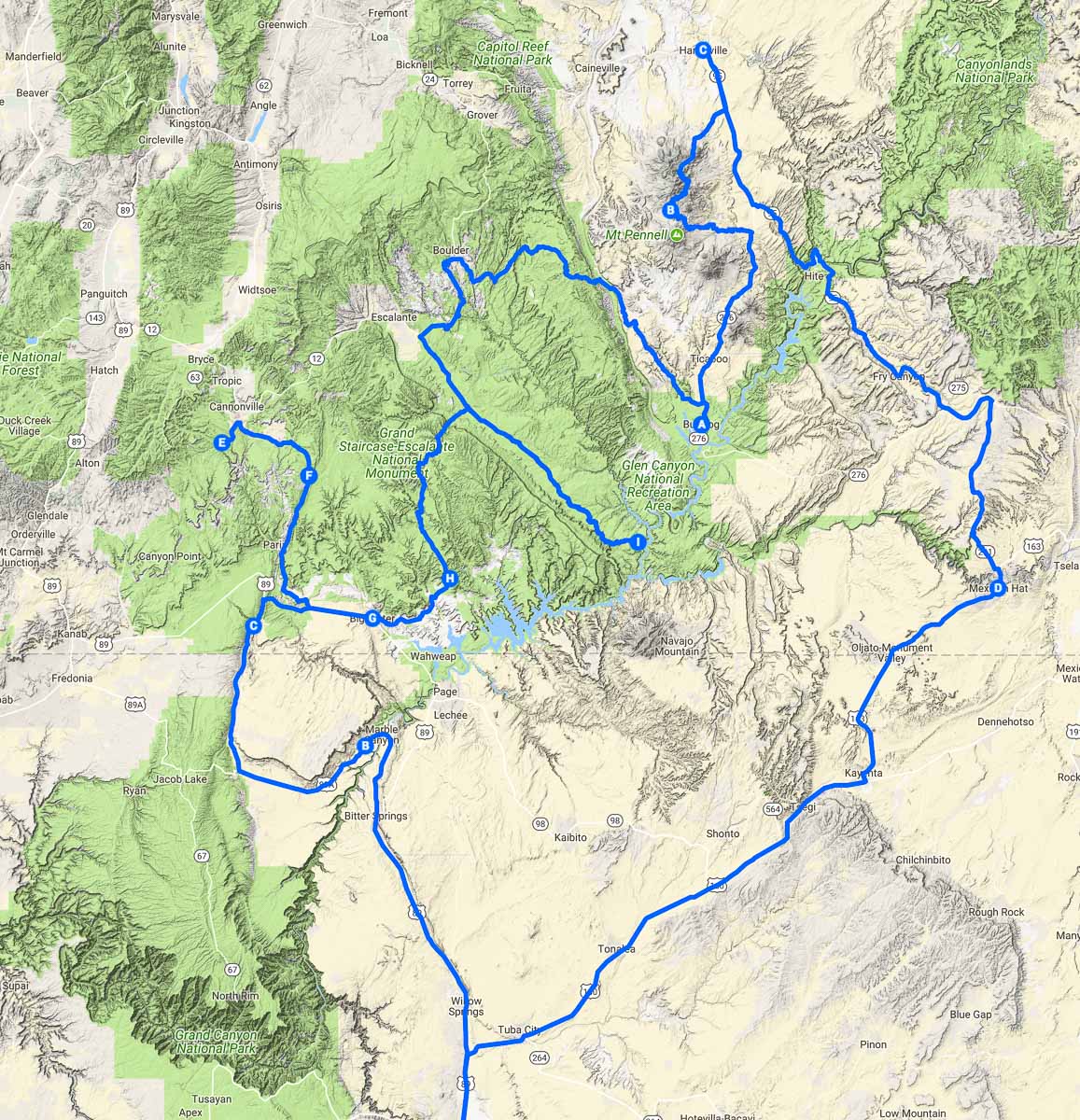
Well, two answers. First, the original plan, back in July, was to start around Mexican Hat and work my way counter-clockwise north through Bears Ears National Monument and Canyonlands National Park to Moab, then loop southwest through Capitol Reef National Park, Grand Staircase-Escalante National Monument, Vermilion Cliffs National Monument, and end up at the Toroweap Overlook on the north rim of the Grand Canyon.
I followed my plan fairly well, and made it past Moab down to Hanksville. I had been on the road for two weeks, at this point, when I suddenly had to head back to Ohio. The second half of the loop would have to wait.
In mid-September my friend Shane and I headed to the Toroweap Overlook for a long weekend trip. So, technically, that would be “Part 2”. Which brings me to the second of my answers: it’s my trip and I’ll title it however I like. :-)
Last year I spent some time traveling around this area in the second half of November, and I knew I didn’t want to do that again. It was beautiful and wonderful, don’t get me wrong, but the nighttime temperatures were in the low teens, and the short winter days didn’t give me a lot of daylight. It made it challenging to get work done – even if I wasn’t a wimp, my chemicals didn’t like being that cold. I stayed in hotels too much, which was definitely not in the budget.
Point is, I knew my time for exploring southern Utah, without freezing me and the chemicals, was running short for this year, so I squeezed in the rest of my original loop in the second half of October. The weather was perfect – highs generally in the mid-80s, lows in the low 40s, I think – plus I had invested in a 0F sleeping bag!
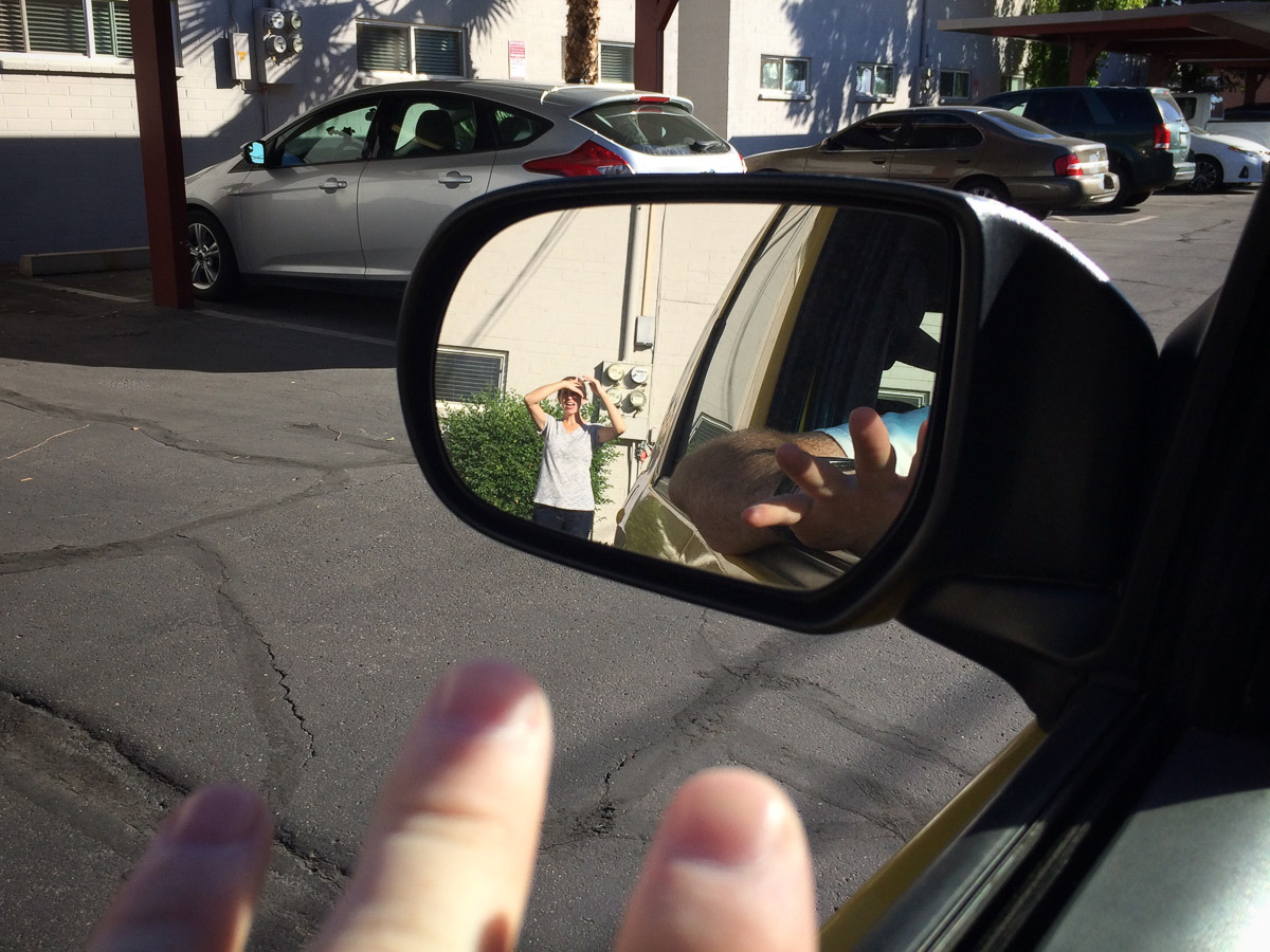
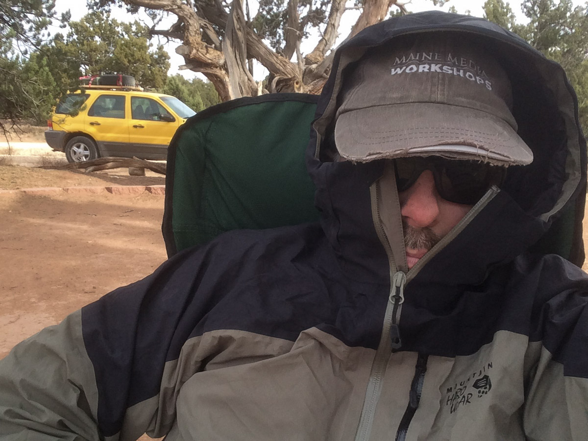
This trip started, as they all do these days, by meeting Shane in Flagstaff for brunch, intel, and gear. The list of stuff I borrow from him keeps growing: air compressor, emergency battery pack, maps, and books. But the most useful thing is advice on where to go, how to get there, what to eat when I get there, and, equally important, where not to go. As in “that’s the Paw Hole Road…you don’t want that” or “do not go past ‘Bobby’s Hole’, you will not come out”, with a 1000-yard stare that speaks of experience.
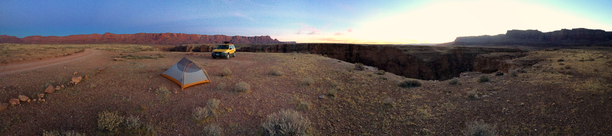
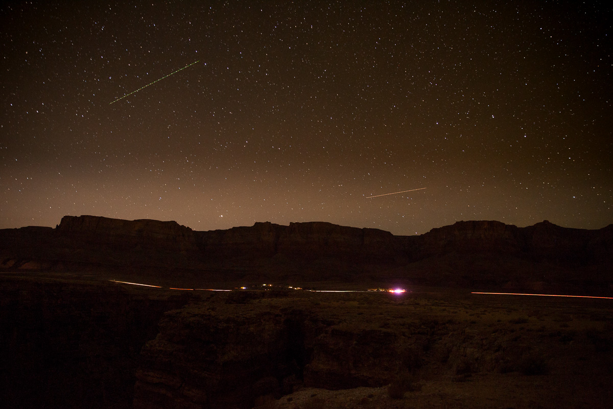
After lunch and stops at various stores for last-minute supplies (and another quart of oil for Flora, who was two quarts down when I checked in Tempe!) I left Flagstaff later than hoped, and raced up to my planned campsite at Badger Canyon, just past Lee’s Ferry, wedged between the Vermilion Cliffs and Echo Cliffs.
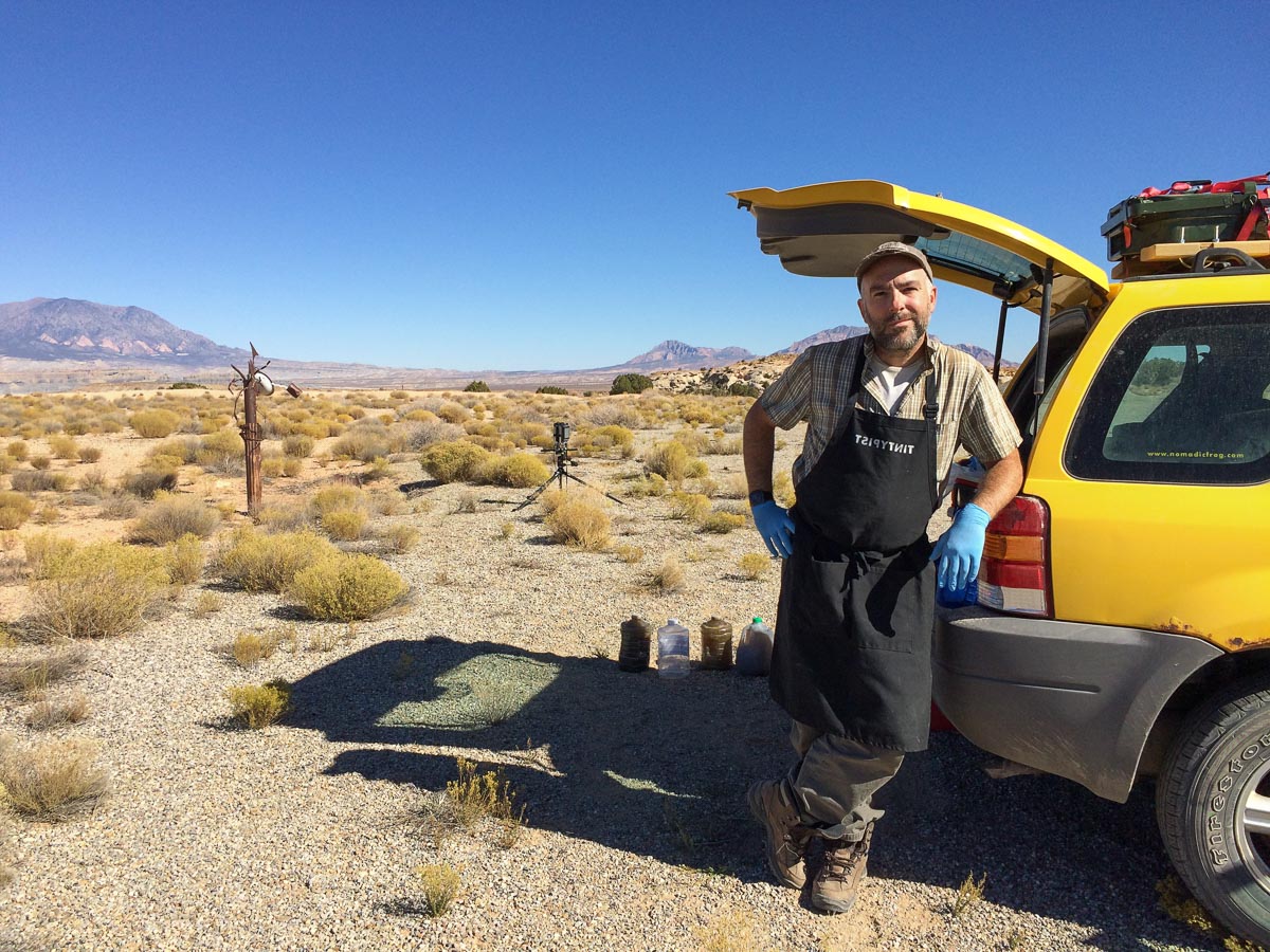
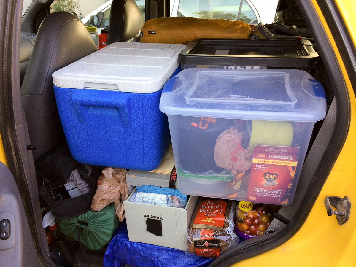
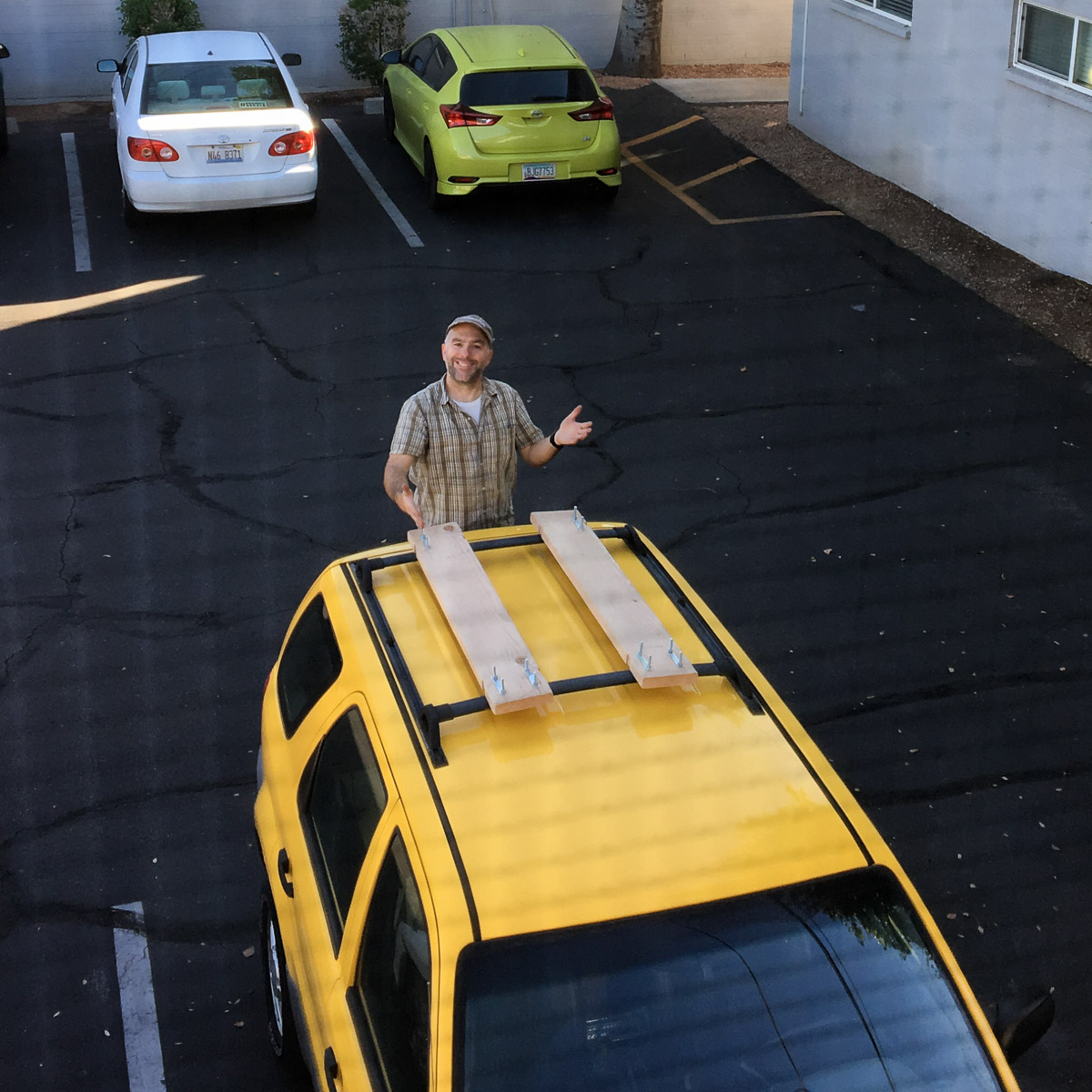
Speaking of Flora (my fiancée’s 2001 Ford Escape), she got some upgrades for this trip. I had been nervous for the 2000 miles of Part 1 for many reasons, not the least of which were that I had basically no equipment for getting myself out of deep sand, and I only had the donut spare that came with the truck. It was full size, diameter-wise, but it wasn’t a regular tire. While Flora has four-wheel drive, and more ground clearance than my Focus, I was not properly equipped to go off the pavement.
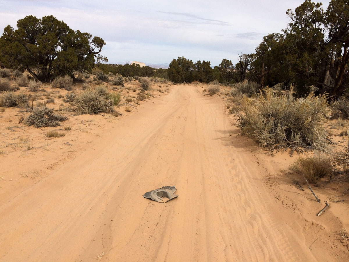
This time around I bolted some 2×8 boards to Flora’s roof rack, in case I got stuck in sand, then strapped a spare tire that I got by scrounging around a junkyard for a rim, then getting a cheap used tire mounted on it, onto the boards. A proper full-size shovel, in addition to the various tire-repair stuff I already had, rounded out my upgrades for this trip. I definitely felt better about my preparedness, but as I found out on my first day in actual sand, there were some idiotic drawbacks to my setup.
I woke up the first real morning of the trip, all excited to make coffee on my new roll-top camp table, only to discover I had forgotten actual coffee. I had some pseudo-instant coffee bags, that weren’t all that great even before they expired a couple of years ago, but I made do, packed up, and headed to my first goal of the trip, the Vermilion Cliffs.
The House Rock Valley Road was fine, and thanks to Shane’s warning about Paw Hole, I took an easy road up onto the Paria Plateau – the top of the Vermilion Cliffs. I was a little worried about what I’d find up there. Over lunch the day before I could tell Shane was choosing his words carefully, trying to decide if my car and my skills could handle it up there in the sand. Then I was reading one of his books in which the author went on and on about the sand in the area that I found out was also called “the Sand Hills”.
It didn’t take long to find the sand. My original plan was to loop counterclockwise (what is it with me and counterclockwise?) along the edge of the cliffs – I wanted to look down on what I had driven along so many times, 1000 feet below. There is a web of roads up there, so I picked one that looked promising, and which skirted what that book said was something like “the worst sand traps on the plateau”.
I made it about 75 feet down one road and got stuck. With what little experience I have now, I probably could have made it through, but at the time I had competing voices in my head, and it didn’t go well. One voice was my friend’s, which sounded very wise: don’t go too fast through the sand: there could be rocks, roots, or holes that you can’t see or avoid. Then there was the author of the book who basically said “floor it and don’t stop until you get to the other side or else they will find your mummified remains in 1000 years”. He didn’t say that, but he was definitely an advocate of “go fast don’t stop”. Turns out my friend’s “don’t go too fast” leaves room for interpretation of what “too” means, and I think, over the coming days, I figured it out for myself a bit.
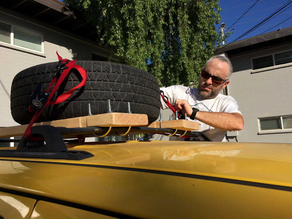
Anyhow, the instant I got stuck in the sand that first time is when I realized that my equipment configuration was stupid. I had used heavy-duty u-bolts to attach the sand boards to Flora’s roof rack, essentially turning them into part of the rack. Onto them I had strapped my full-size spare wheel and a five gallon jerry can of fuel with a web of ratchet straps.
I had naively assumed that getting stuck in sand would be a rare and temporary emergency. Get stuck, undo everything to get the boards down, get out, pack up, move on. It would suck and take a couple of hours, but hopefully it would never happen, and if so only once.
Up on the Vermilion Cliffs, though, the potential for getting stuck in deep sand wasn’t a rare possibility, it was a constant reality. I needed to be able to get those boards down, and stowed again within a few minutes, not an hour or so, and several times a day. And without having to deal with a heavy spare wheel or 50 pounds of gas in a big metal can while standing on a tire and leaning over the roof. My whole setup needed a re-think.
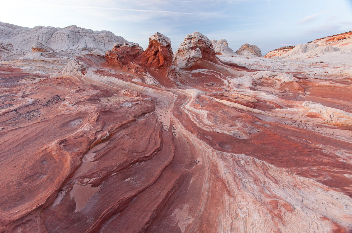
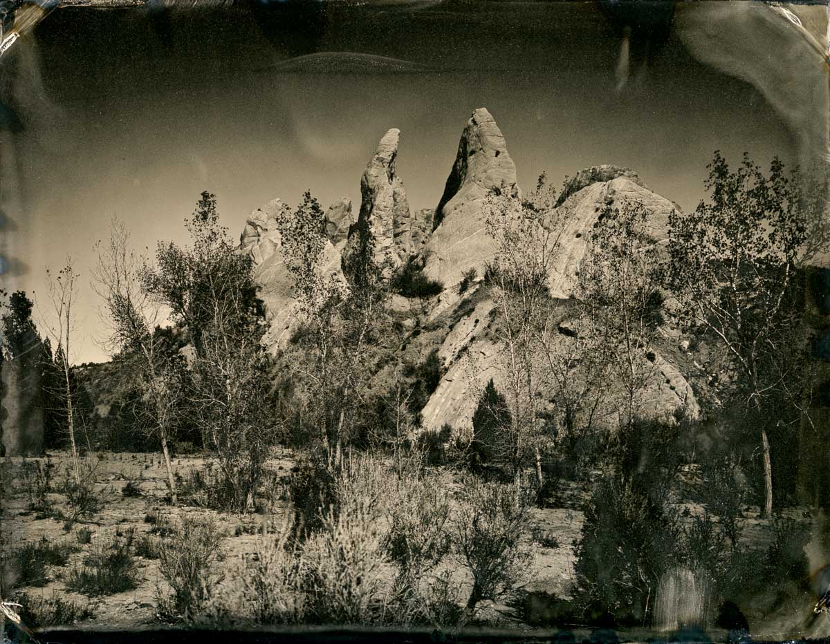
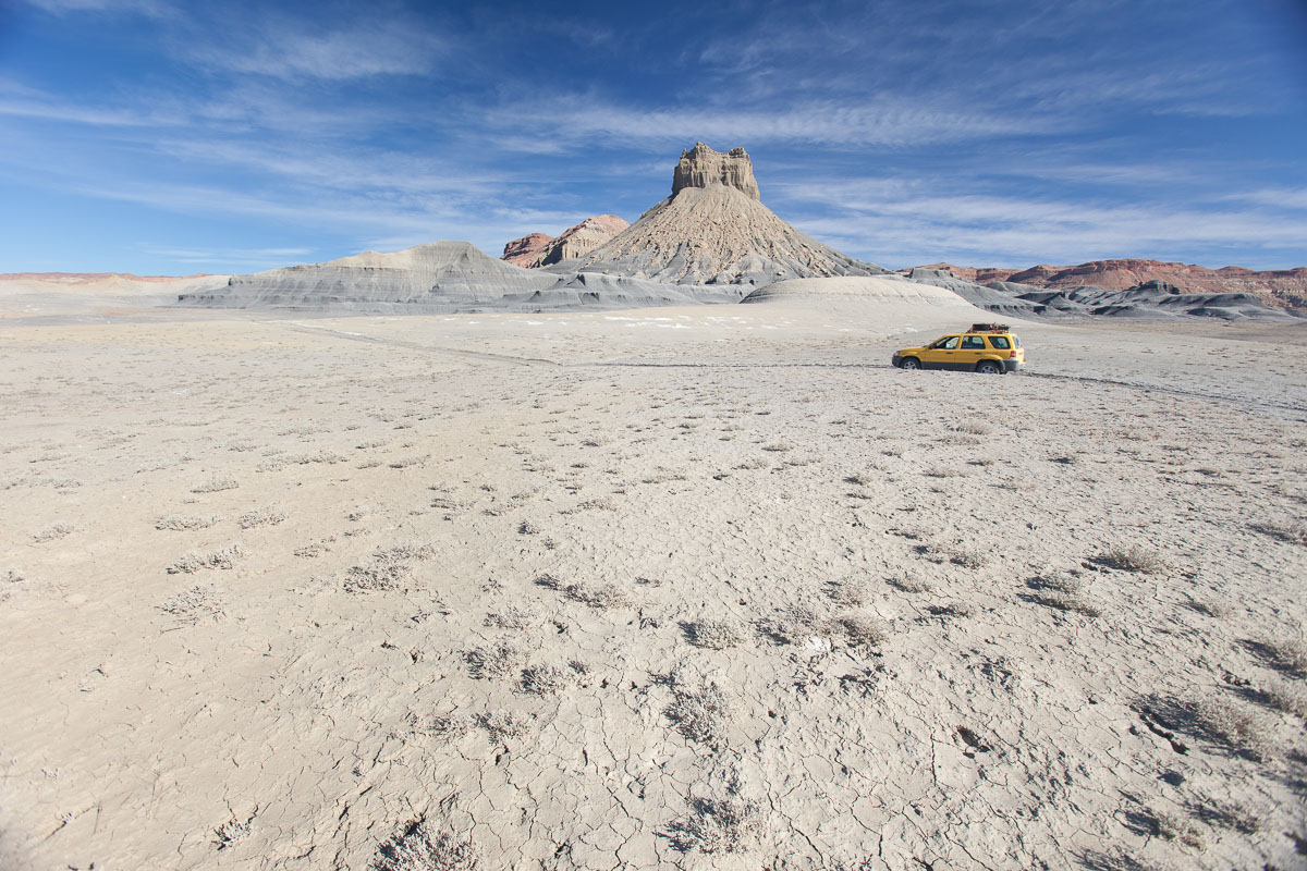
As did my route around the Cliffs. Instead of my loop around the cliff edge, I took a different road that looked more firm, at least to start. I had no idea where I was going or what was out there, but as luck would have it, I had chosen the road out to an area called White Pocket, and it was amazing. The road also had deep sandy areas, but for some reason I decided to plow through. I eventually found what I felt was a happy medium between Shane’s caution and the author’s “floor it” mentality – I definitely needed some momentum to carry me through the bits where the sand polished the underside of Flora – and bits of other vehicles’ undercarriages littered the road.
It was more like…surfing, at times than driving, and in many cases the ruts in the road did more of the steering than I did. It would have been fun if I wasn’t worried that I was getting myself deeper into the wilderness, with no people to help if I got in trouble. As far as I knew I was the only person up there, with a few cows (and one of them was dead and bloated beside the road).
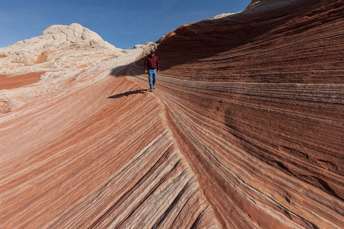
Eventually I made it to White Pocket…where there was a large parking area full of trucks. So much for being alone in the wilderness. (It did give me great peace of mind, though, when I faced the sand on the way out – as long as I wasn’t the last to leave, I knew there would be somebody coming up behind me eventually.)
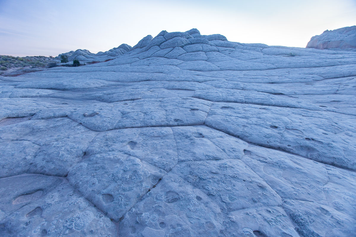
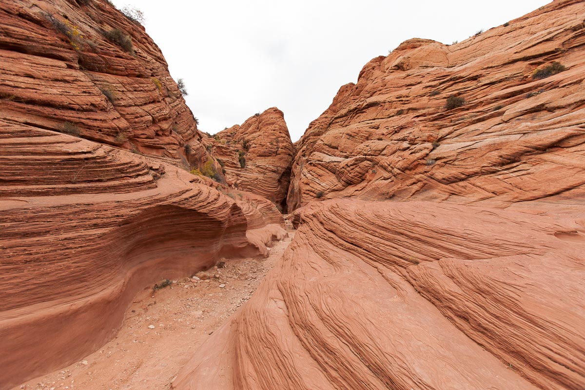
White Pocket is an area of exposed rock up on the Paria Plateau. It’s near the more-famous Wave and Coyote Buttes, and in some ways looks very similar, with the added bonus of having unrestricted access. (To get to The Wave you have to get a permit which you either have to do months in advance or win a lottery the day of your hike, and total permits are limited to 20 per day.)

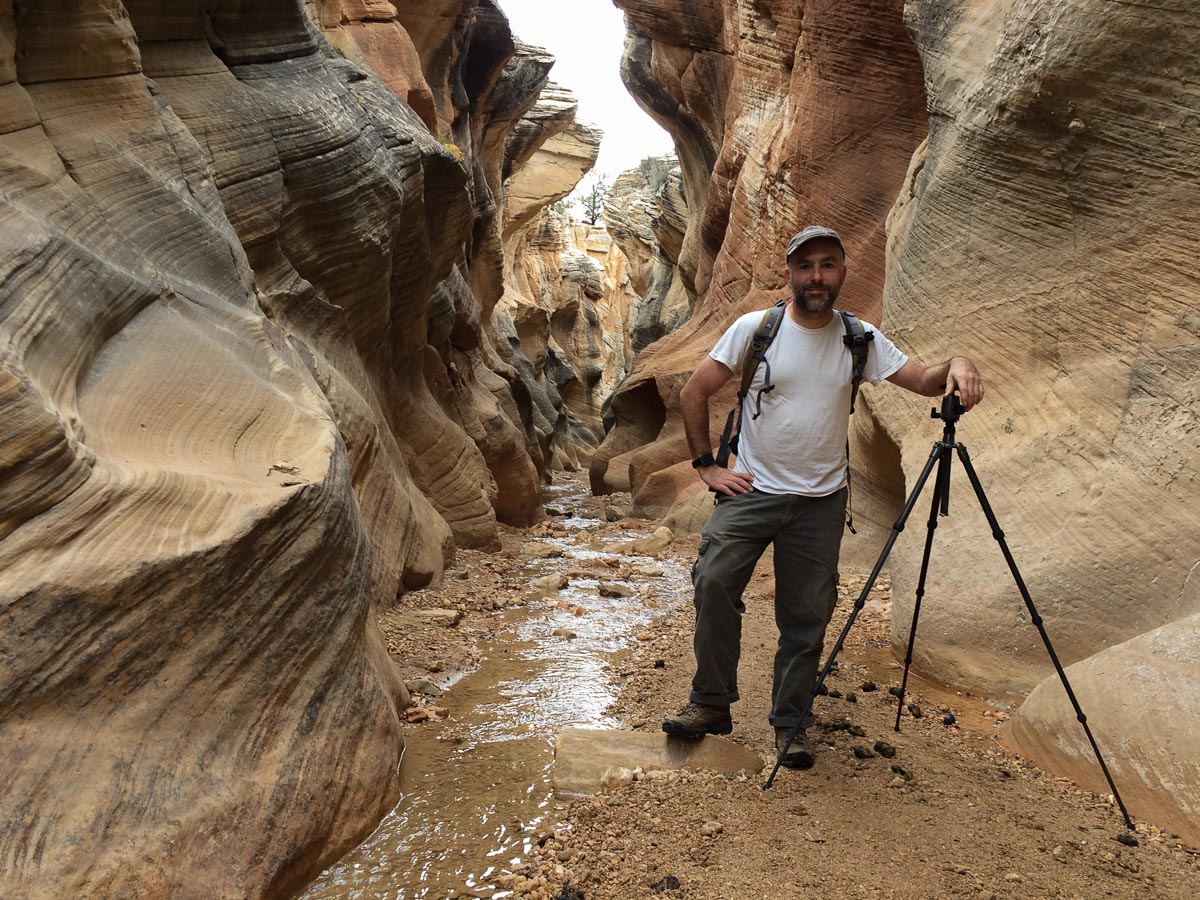
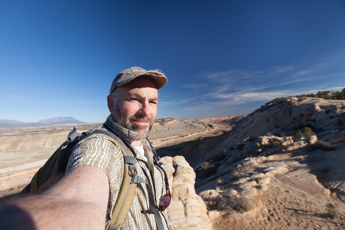
I set up camp, then grabbed some food, my digital camera, and tripod, and headed out onto the rocks to eat dinner and photograph through sunset. I had also scouted out a place to photograph sunrise, hoping that the sun would light up a little curve in the rocks, but my angles were off and it didn’t really work out as planned. The area was a bit far from the parking lot, through some more sand, so I also didn’t haul my tintype gear out. Next trip I will have a small folding cart, and I’ll be able to get to some stunning areas to make tintypes!
Among the several people at White Pocket was a very friendly guy, Royce Bair (website / Instagram), and we got to talking. He does some fascinating night photography (check his website for images and info, and his Instagram feed for more of his photos as well as others he curates from around the world – many from his students). He was interested in my tintype setup and featured me on a one-day Instagram story, which was pretty cool.
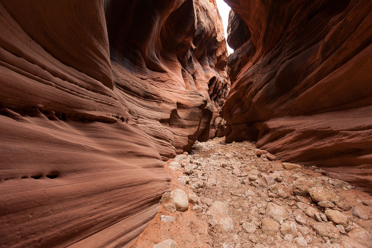
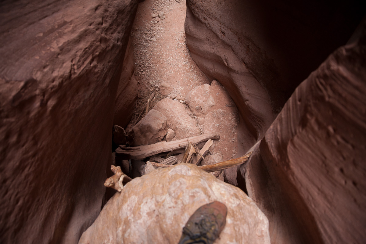
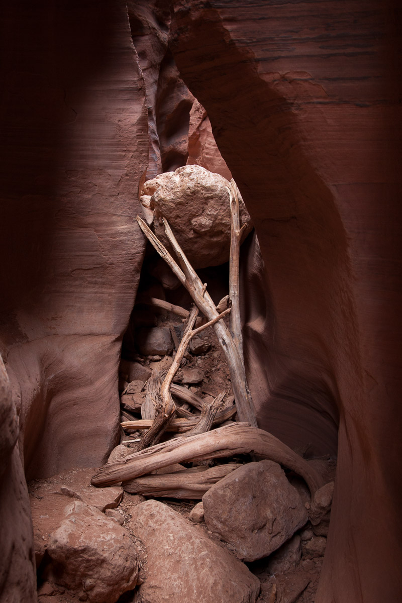
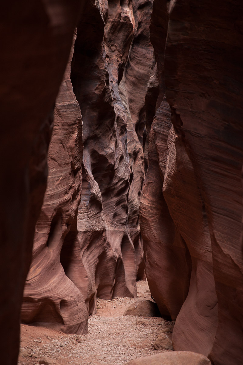
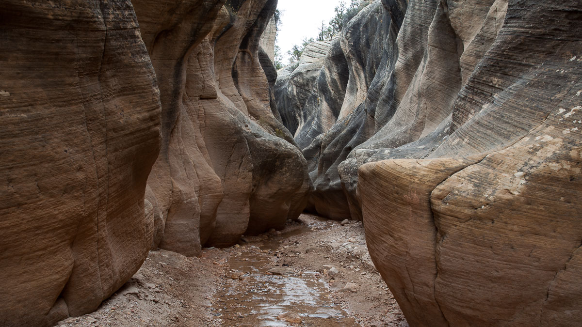
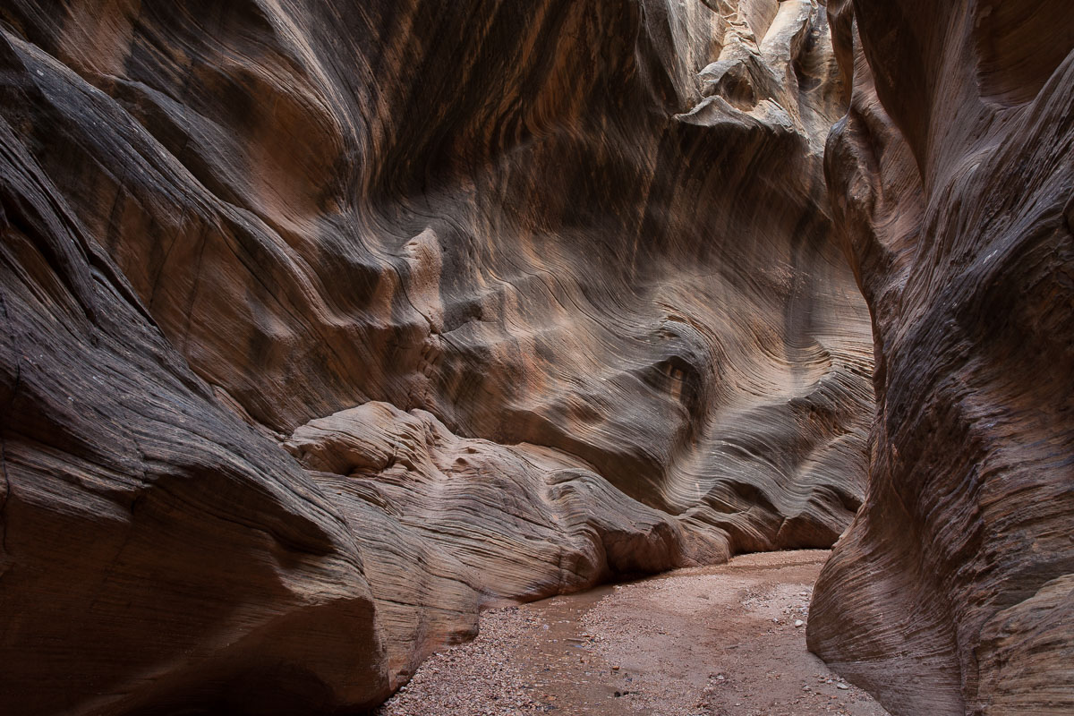
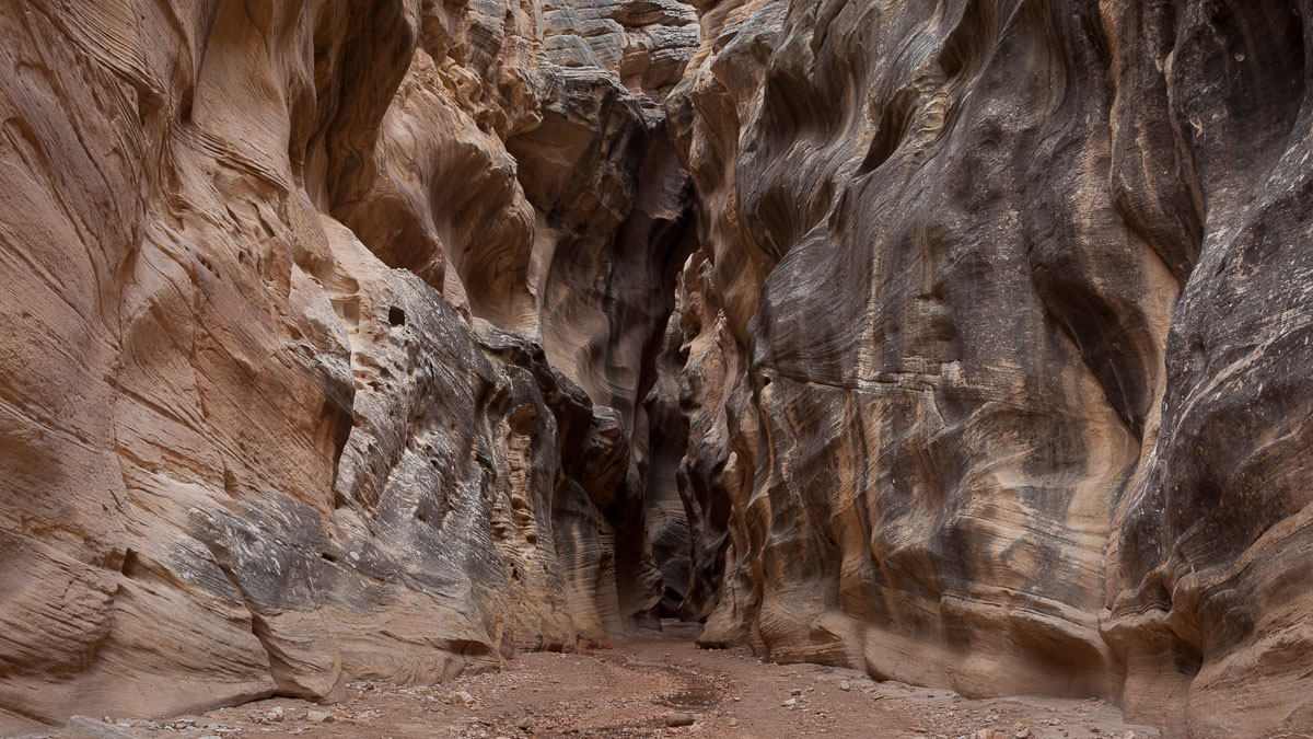
I had already decided I was done with the Vermilion Cliffs – I’d have to come back with Shane and his Tundra to really explore it – so I surfed my way out of the White Pocket area and back down onto the House Rock Valley Road. I had enough daylight left to check out the next item on Shane’s list of suggestions, Wire Pass Canyon and Buckskin Gulch. At least part of the latter – turns out it is one of the longest (the longest?) slot canyon in the area, and I only saw the very first bit.
Previously I had only been in Upper Antelope Canyon, outside of Page, Arizona, and with the required “Navajo” guide (in quotes because, as it turned out, our guide Charly was actually German, but that’s a whole different story). It was pretty neat to get to Wire Pass and just walk into another amazing slot canyon.
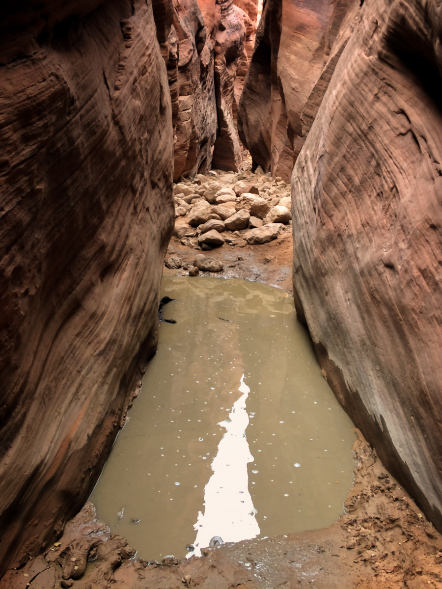
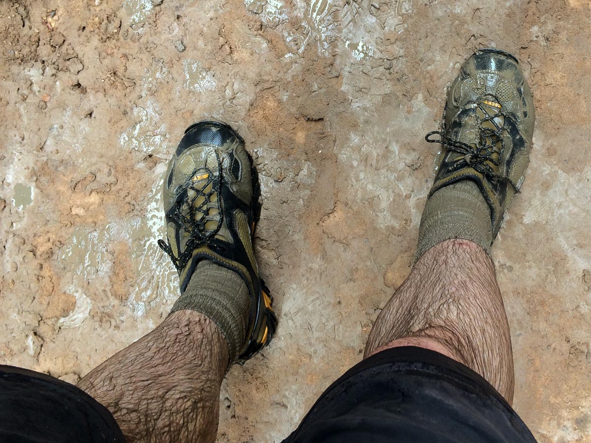
I had been told that there were pools in Buckskin Gulch, and that I’d have to get wet. I had envisioned nice clear running water – no problem. Turns out what they should have said was “there are puddles of cold stinking slippery muck”. It was worth it, though, to slog through the ten or so ankle-to-thigh-deep mosquito-larvae-infested sections to see the stunning canyon, before the coming darkness forced me to turn around (and wade through them again) to get out.
From Wire Pass I headed into the Big Water area to get gas, water, food, and road condition information from the BLM offices there, before driving up the Cottonwood Wash road along the Cockscomb ridge, into Grand Staircase-Escalante National Monument (GSENM).
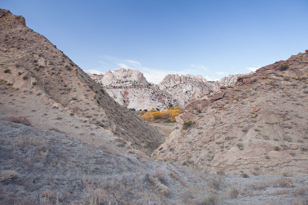
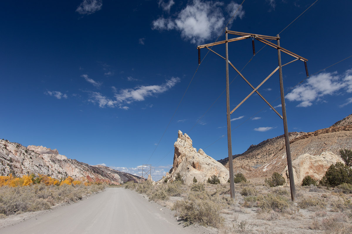
The Cockscomb is a spectacular strip of land at the edge of the Kaibab Plateau, where layers of rock were turned on edge and are exposed in jagged knife edges. Unfortunately the Cottonwood Wash road was built primarily to service large power lines that take advantage of the long straight valley, so the sweeping views of this landscape inevitably have pylons and wires running through them.
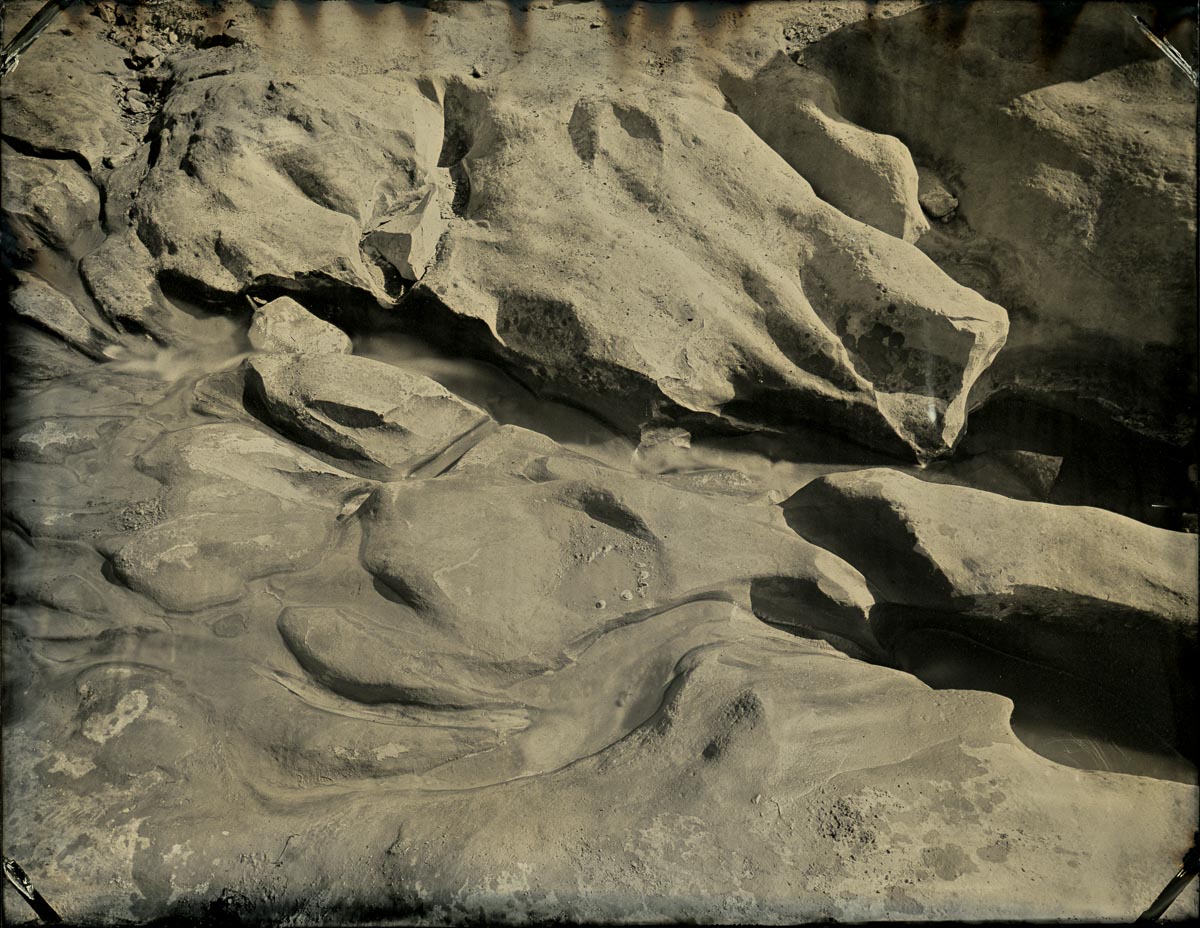
I spent the afternoon exploring the Willis Creek canyon, another beautiful slot canyon in GSENM. As with White Pocket and Wire Pass Canyon, the main section of Willis Creek was just too far from the car to carry all of my gear, so day four of the Great Tintype Adventure Part 3 passed without a tintype being made. The creek had carved some interesting shapes in the surface rock at the head of the canyon, though, so I resolved to come back in the morning and give it a shot.
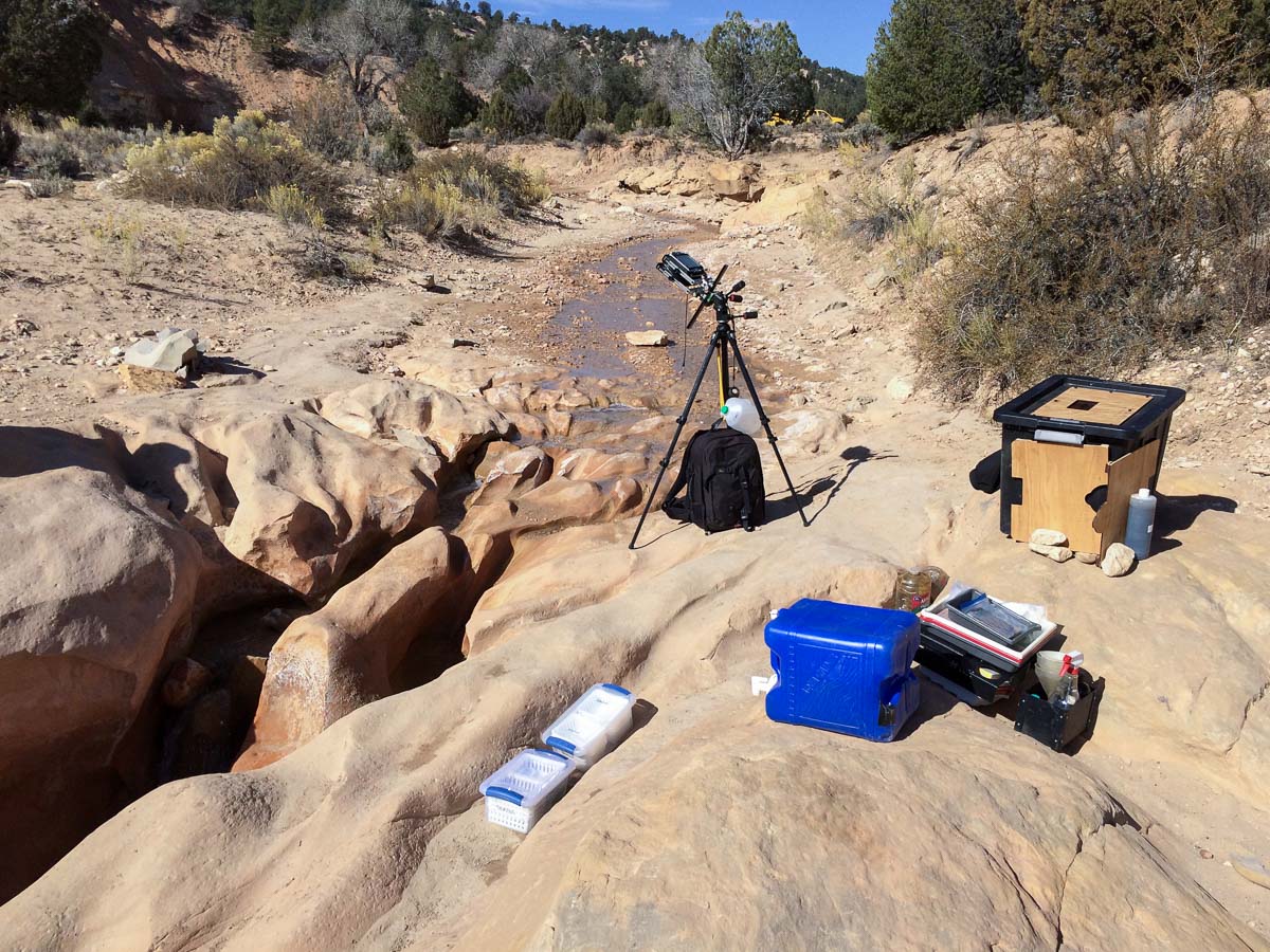
The next day was beautiful and clear, but there was a stiff breeze that steadily grew into a constant wind with periodic strong gusts. The area is very dry, and the dirt roads swirled with dust in general, and especially whenever a truck would roar by.
I set up my gear and managed to make only one image before the blowing sand started to be an issue, and shortly after making my second plate a gust blew my darkbox over. Fortunately I had anticipated that might happen, and I had locked my silver nitrate tank. I didn’t loose any chemistry, but there was sand in everything, and I had to chase down trays and other gear that had been scattered by the wind. I decided I was done for the day before I’d even really started.
From Willis Creek I retreated back down Skutumpah Road to Kodachrome Basin State Park. I wanted to stay there because a) I hadn’t seen it and was curious, but more importantly b) they have showers.
As I drove along the Cockscomb the previous day I noticed a few spots that I might photograph, so I headed back down and stopped to make the first real tintypes of the trip.
After that I went back into the Big Water area for the usual stuff: water, food, gas, and info.
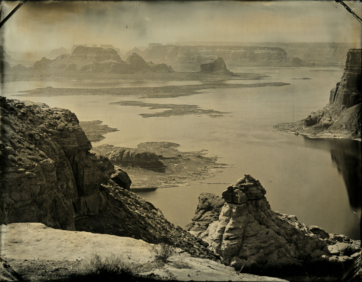
My goal for the night was Alstrom Point, a supposedly stunning spot overlooking Lake Powell. A lot of times out in these desert areas there is a web of “roads” and tracks, some of which are legitimate, and some are from jerks with trucks and off-road vehicles just going wherever they want. So the published maps don’t always agree with what I see, and aren’t always 100% accurate anyhow: the “Alstrom Point” is labeled as being in slightly different places on each map.

During a normal daytime exploration none of this would be a huge problem, since you could just roam around and see what is at the end of each road. But since going to “the end” of any given one of these roads could be a careful multi-hour crawl, it isn’t all that feasible when the sun has already set and night is coming on quickly, as was the case on this day that started far away in Kodachrome basin, and which involved a tintype session and a trip nearly into Page for food and gas.
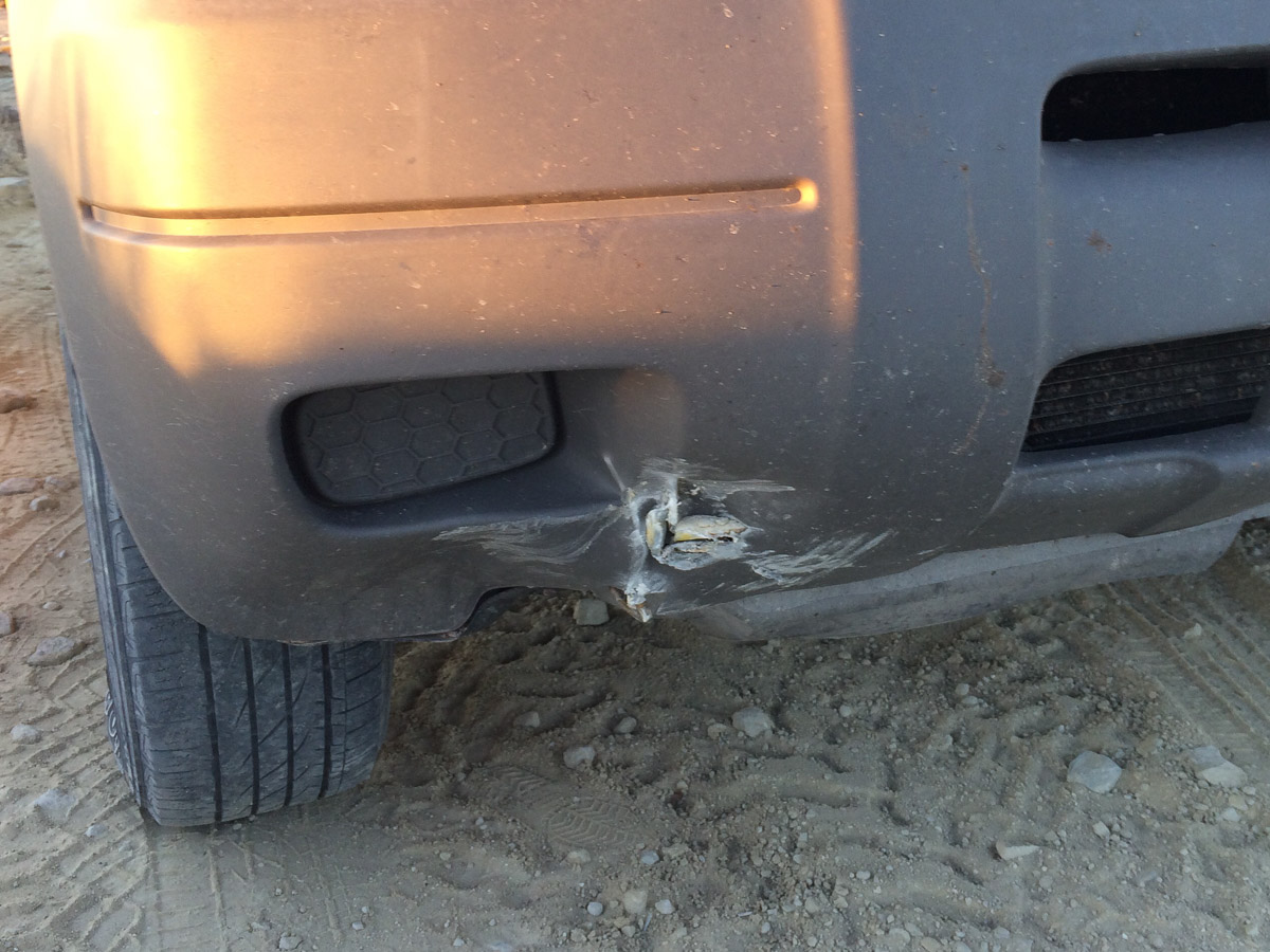
The point of all that is that I was getting a little bit anxious about getting to Alstrom Point, and very worried about driving on rough roads, in the dark. As is often the case, this is when accidents happen: I got in a hurry, misjudged Flora’s turning radius, and…
After that, and in near darkness, I finally decided to stop, pretty much in the middle of the road (which at this point was basically just an expanse of rock, so I wasn’t really blocking anyone) and try to find a flat spot for my tent. Right then I saw some headlights bouncing toward me from what I thought was the Alstrom Point direction. Pretty soon a big Sprinter van came up, and I flagged it down for info.
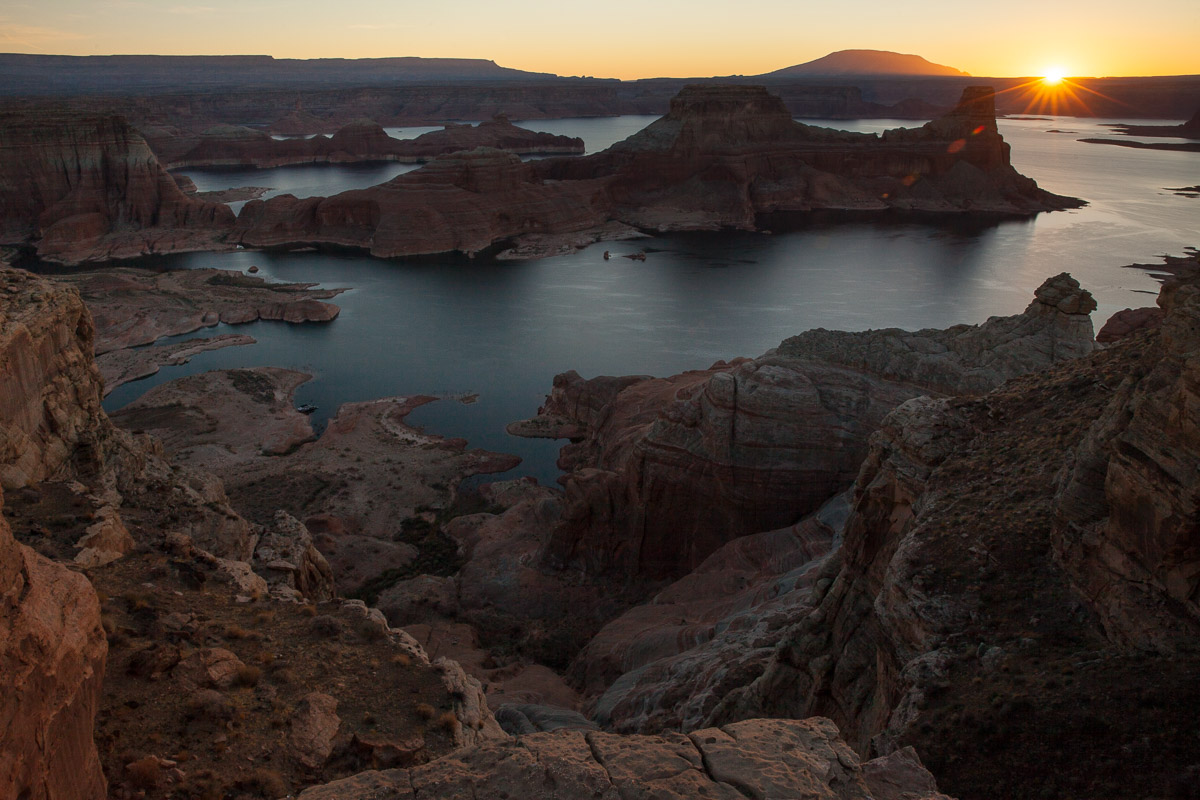
The driver told me that yes, this was the route to Alstrom Point. When I asked about the road conditions and distance, he said “dude, you’ve passed the worst of it – what you just drove through (where I crashed Flora into a boulder) is by far the worst”. He told me the point was only another 3-4 minutes of easy road, and to “go for it – it’s the best campsite in the world!”
So I did. He was right, about the road at least. I’ve camped in some amazing places, so it had some competition for “best in the world”, but it was indeed pretty great, and it felt good to have pushed through.
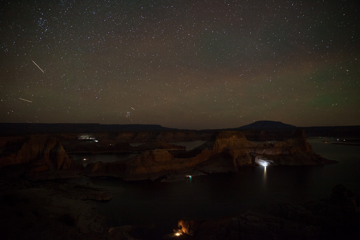
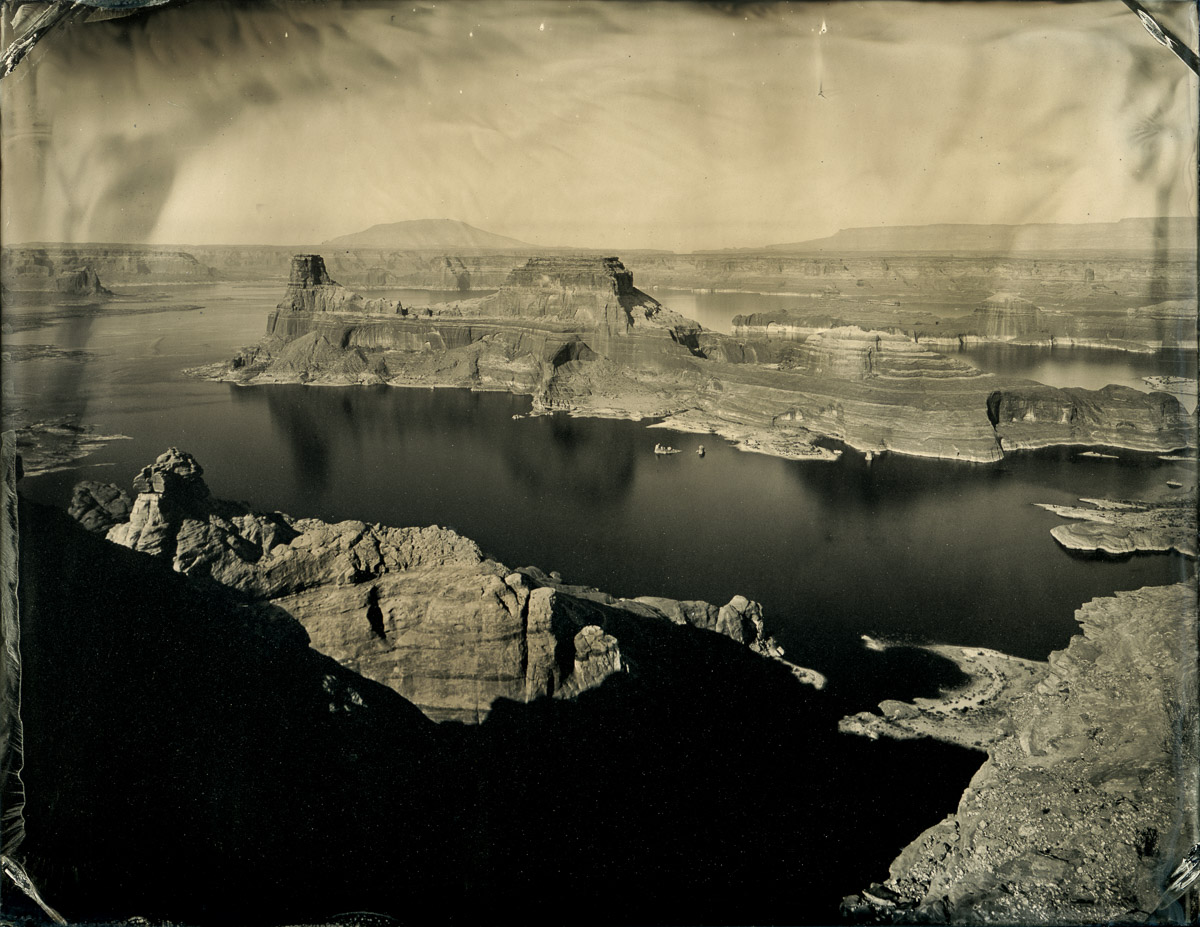
Alstrom Point was very pleasant, and I felt like there were plentiful photographic opportunities, so I decided to stay a second night, and spend the day making tintypes of Lake Powell and the buttes, mesas, and mountains receding in the distance.
On the drive out from Alstrom Point I set up my phone to record a video of me driving down through the section of rough rocks where I banged the car into a big rock, thinking I’d show how gnarly the road was. In the calm of bright daylight…it was no big deal.
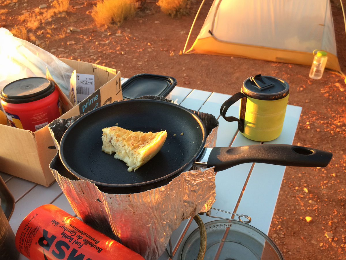
From there I got back on the Smoky Mountain Road, which quickly wound its way up a series of switchbacks and up onto the Kaiparowits plateau. The drive north to Escalante was beautiful but relatively uneventful. In Escalante I followed Shane’s advice and got some pizza at Escalante Outfitters. There, in order to get to the tables on their patio, I had to pass by a display case with large cheesecakes, pastries, and quiches, so when I left I had not only half of my leftover pizza, but also a slice of cheesecake and a piece of quiche, with some grapes and an orange.
I did the usual I’m-in-civilization stuff (gas, food, water) and checked in at the BLM office for road conditions. Back at Escalante Outfitters the server, Nate, had given me a bunch of great ideas and advice about where to go, what to see, and where I might find good campsites, and from the BLM office I headed down Hole-in-the-rock Road and Harris Wash to a nice little campsite for the night.
The next day was designed to make tintypes at Devil’s Garden, but as had been the case with other locations, the formations there were, while an easy walk, just a bit too far to carry all my tintype gear. I added Devil’s Garden to my location scouting list for the next visit.
After Devil’s Garden I went back up to Escalante and tried to find one of Shane’s maps that I accidentally left either at the Outfitters or the BLM office, but it was nowhere to be found.
Route 12 in Utah is amazing, but I had been over it a few times, so instead of taking the relatively short route to Boulder, I headed up over Hell’s Backbone and took the longer back way. From Boulder I went out the Burr Trail Road.
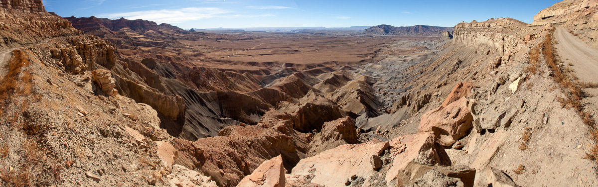
I’d been down this way before, but I hadn’t known about the Strike Valley Overlook, so that was the goal for this afternoon. Unfortunately I got there pretty late in the day, and the “road” out to the overlook was another one of these where I had to stop several times and scout a route through the boulders and ravines. By the time I got out to the overlook I didn’t have much time to enjoy it, since I needed to crawl back out to find a campsite.

The other thing about these roads / trails is that aside from getting stuck, and the resulting danger / expense, I don’t want to drive a vehicle *everywhere*. I don’t want noise and exhaust fumes filling all the natural areas.
So one of the things on my mind when I’m out there is trying to find the balance between getting me and my tintype darkroom gear to interesting places, on established roads, without increasing damage to the landscape.
I encountered two hikers on the way out to the Strike Valley Overlook. I got out of my car to scout my route through some boulders, and waved to them when they came around a corner. No response. Said “hi” when they got closer. No response. As they were passing they said “you should just park it and walk – it’s a beautiful hike” and cruised on past.
It didn’t work out, but as always on this trip, I had hoped to make some tintypes at the overlook, which requires a certain amount of equipment. I barely had time to mumble something about “you don’t know all the factors here” before their smugness rounded the next bend and disappeared.
They drove a vehicle (possibly two, in fact) to their trailhead, and I was on a legitimate “road” where vehicles were clearly allowed. Apparently the 2.5 fewer miles they drove made them superior? Anyhow, I didn’t feel too bad about being out there, in this instance, but I don’t want to create any new tracks or otherwise damage the land, and I see lots of off-roaders doing it, or evidence that they have.
My trip was getting to the end, and I still had a lot of ground to cover, so I drove on down the Burr Trail Switchbacks, cut across the southern tip of Capitol Reef National Park, and climbed up the other side on the Notom-Bullfrog road. I found a large gravel area that seemed to be a good place to camp, with a nice view of the Henry Mountains.
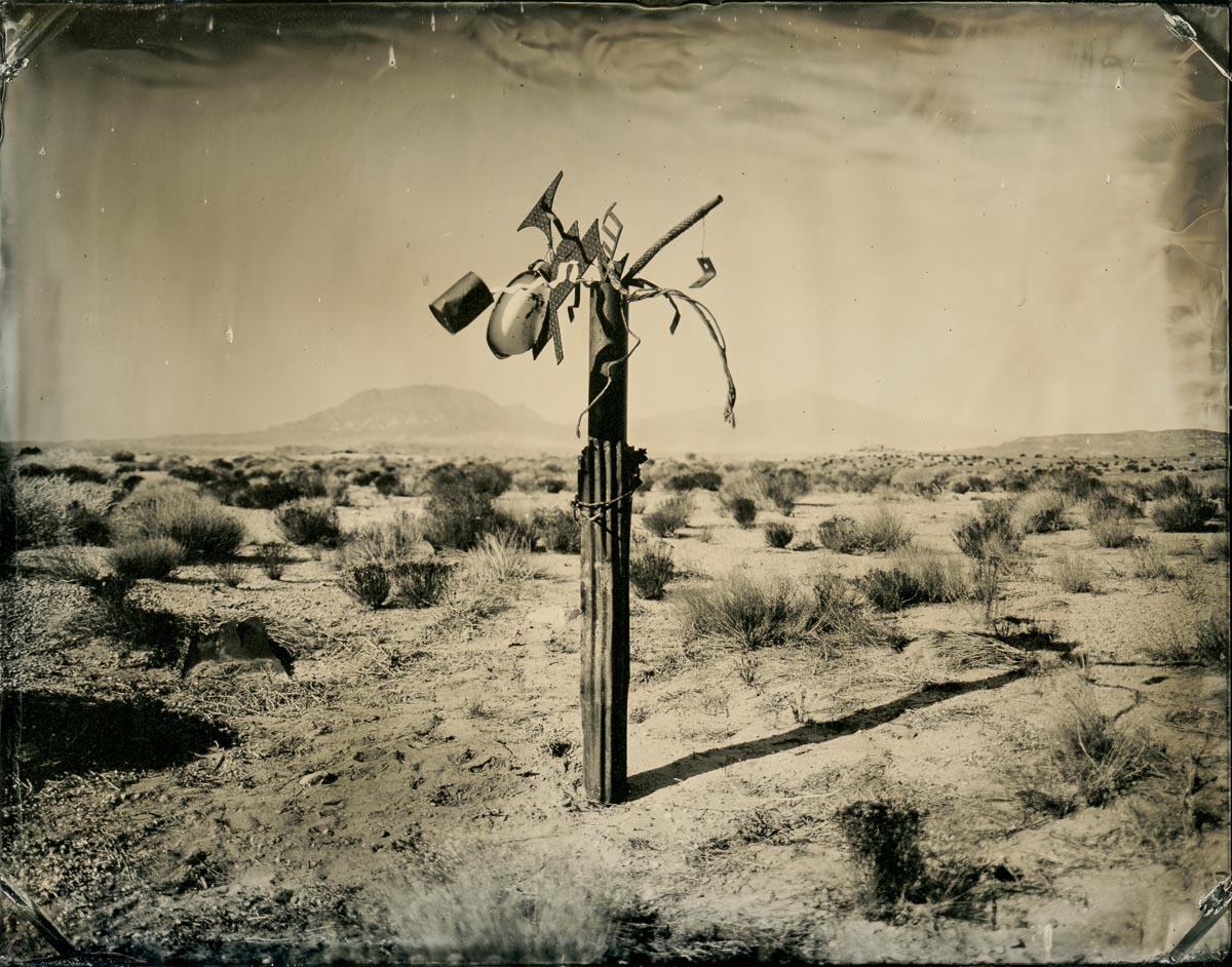
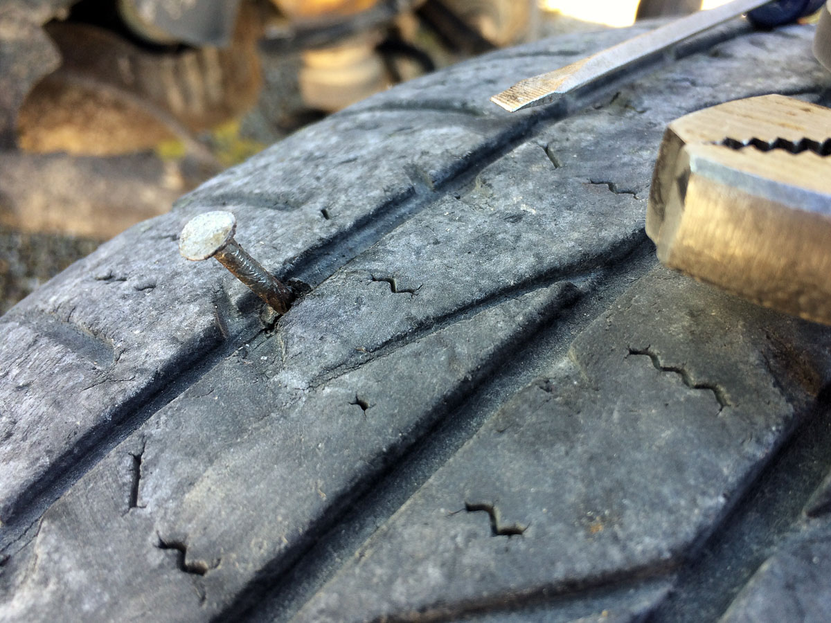
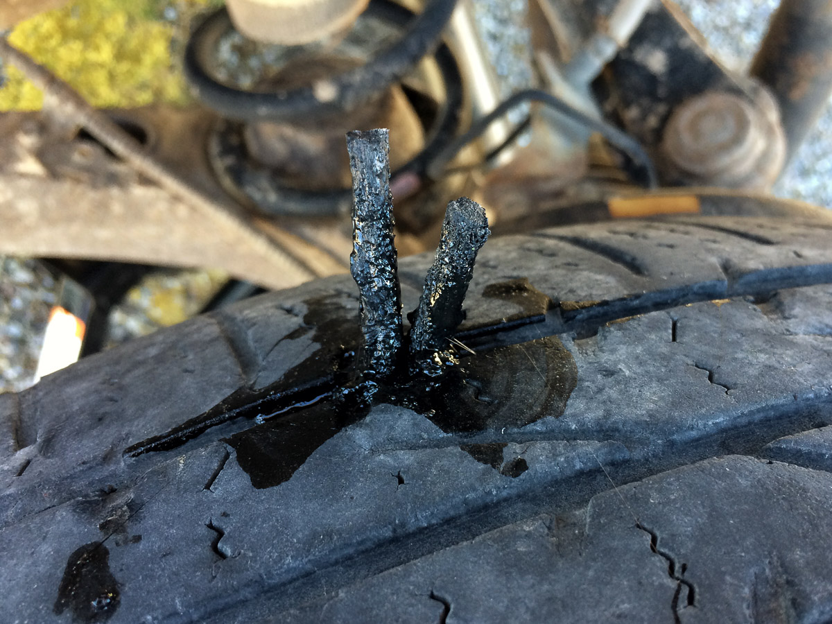
There was also some strange…object (still not sure if it is art or garbage, or both) which I thought I might photograph. After breakfast the next morning I went to move Flora closer to the construction, only to discover that I had picked up a nail and had a flat tire.
So I spent the morning of my last full day making tintypes, then I sat down to see if I could figure out how to repair a tire puncture on my own. I had several options: Fix-a-Flat, puncture repair kit, full size spare, donut spare.
I figured the Fix-a-flat was a last-resort, since I didn’t know what that would do to the tire long-term. The donut was next to last option, since that would slow me down unnecessarily, since I had the full-size spare which would just be like a normal tire. But getting the full-size spare down off the roof – and the flat back up there – would be a pain in the butt, and I had this puncture repair kit, so, why not find out if it works?
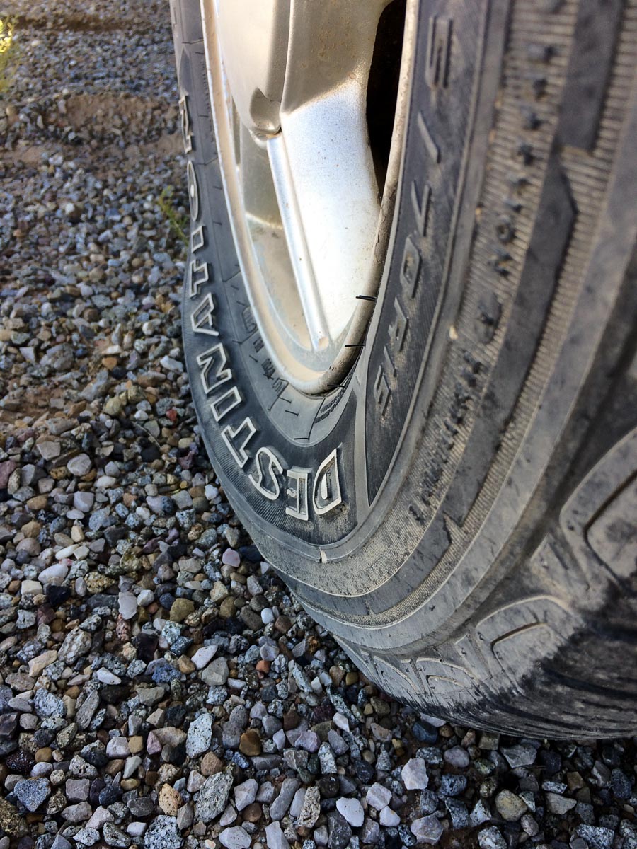
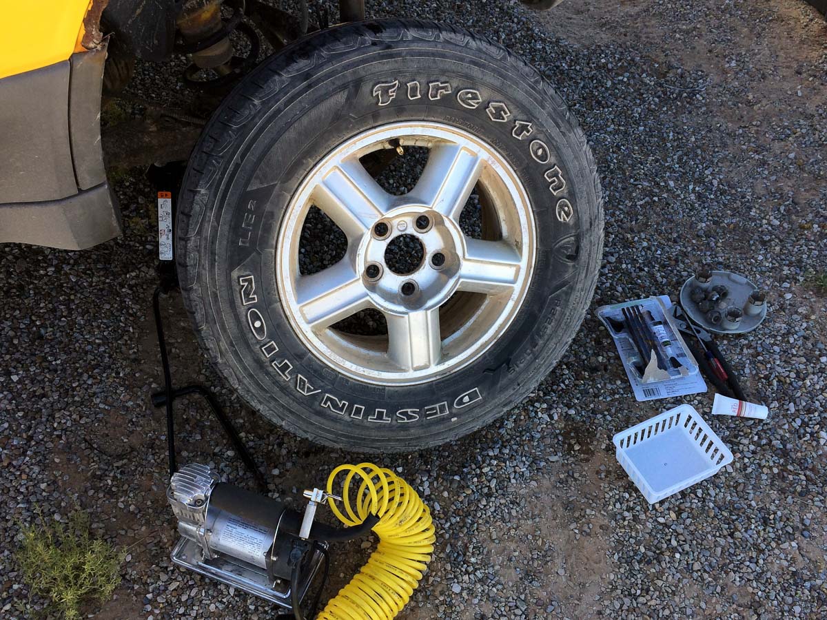
It only took a couple of hours, including unloading the trunk to access the jack (another thing to change next time), fixing the tire, eating lunch, and washing the morning’s tins, and I was back on the road. I took it easy for a while, with the driver’s-side rear-view mirror angled down so I could check on the tire periodically, and drove down into Bullfrog for gas.
Everything seemed to be fine with my tire plug, so I headed back up the other side of the Henrys to Utah 95, then zipped down through stunning scenery to Lake Powell at Hite, and back up past White Canyon and onto Cedar Mesa just south of Bears Ears.
As I was driving south across Cedar Mesa an oncoming car flashed its lights at me. I flashed mine back, to show I was already using low beams (and Flora’s low beams are really low). The driver kept flashing, and as I went past I realized he had stopped completely.
I came to a stop and backed up to see what the deal was. It was a Ford Mustang with California plates – something of a typical rental car that tourists get to explore the west.
I looked in the window and there is a guy driving, in jeans and a tanktop, and a woman in the passenger seat, also in a sleeveless shirt (this is late October, at around 7000ft elevation, after sunset – it was chilly). I didn’t see any jackets, clothes, or anything else in the car. It looked like a day trip.
The guy asked if this was “the road to the city”.
If you know this area at all, you realize there are many troubling / funny things about that question. First, this wasn’t a road to anything but another road, and that road (Utah 95) didn’t lead to anything any time soon either. He was miles from a gas station, much less “a city”.
We went back and forth as I tried to figure out what he was really asking and what he needed to know. He kept asking for the nearest city, and I just had to think for a minute about what counts as a city in these parts.
I said the closest place was Mexican Hat. “Is that a city?” Ha ha ha. But at least there is gas and some hotels. “I tried to go down that way, but I was scared of the switchbacks in the dark.” (The Moki Dugway.) I mentioned Page, Kayenta, Moab, and Flagstaff as “cities”, but explained that none of them were close.
I asked where they were headed, and he said “Los Angeles…but we can sleep along the way”. “What city is along the way back to LA?” Um…Hanksville?
In the end he decided to head for Blanding, since there his GPS would work and he could figure it out from there.
I really had the feeling they had wandered around and just completely misjudged the size of the land they were in. They were relying on their cell phone for maps – no paper maps, and no cell reception. And no idea about the climate. By the time I said goodbye and good luck, the man was visibly shivering.
After helping (?) the visitors from LA I drove down the Moki Dugway switchbacks in the pitch black darkness, which was an interesting experience. Fortunately I’d driven the switchbacks a few times already and knew there wasn’t much to worry about. I finally pulled into the San Juan Inn and got a room (with, critically, a shower).
The last day I basically made a beeline for home, with a brief stop in Flagstaff for a debrief lunch with Shane.