I have made several trips through southwest Utah in the past year, each time taking my little (and low-slung) Ford Focus further down dirt roads than I should, each time asking the guy changing my oil afterward if everything looks ok under there.
“There’s a lot of dirt and some grass stuck in funny places, plus this (hands me a few pieces of something yellow) that you ran over, but you didn’t do any real damage.”
No matter how far I push my car, though, there are always roads that promise amazing experiences just past where I finally wise up and turn back toward the pavement. So, this summer, while Kari was off teaching in Maine and visiting family in Minnesota, I got to use and abuse her beloved Flora, a 2001 Ford Escape.
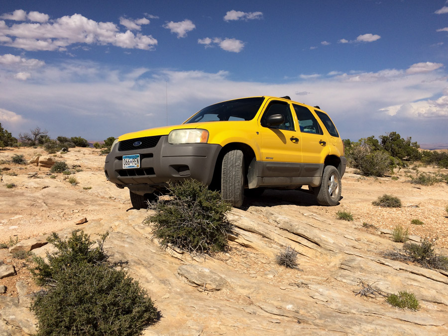
Now, while the Escape does have four wheel drive, and certainly more clearance than my Focus, it is most definitely not a hard-core off-road vehicle. It wasn’t even when it was new, and Flora is not new: 17 years old, 150,000 miles, and the 2000 model year was the very first for the design, so lots of design issues. The single spare is not a full size tire, and none of the tires are designed for off-road use.
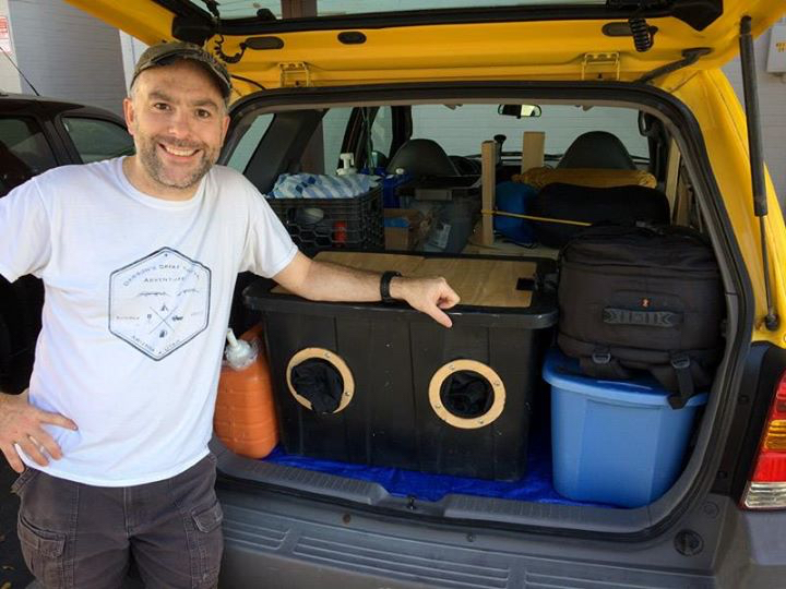
In short: this is not the ideal vehicle for such a trip, but it’s what I had available. I was sure to have plenty of water (at one point just over 20 gallons for me and my tintype making), various means of communicating, plenty of food, some tire repair materials, and made sure my AAA was up to date.
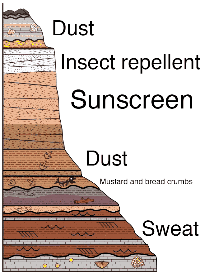
Nor was July the ideal month to explore the Utah desert, but again, that’s what I had to work with. As I got into a rhythm, I would get up at or just before dawn, and pretty immediately get to work making tintypes until 11 or 11:30. It’s easy to spend a couple weeks in the desert, once you’ve come to terms with being covered in repeated layers of sweat, dust, sunscreen, and insect repellent for the duration.
At that point I’d pack up and find a shady spot for lunch and to cool off. My current process for washing my tintype plates in the field is to first just stick them in a large tub of water, then do a multi-tray rinse later in a more controlled environment, i.e., a shady lunch spot.
I would usually spend the afternoons in the relative cool of the airconditioned car, either getting to the next location, scouting specific shots, and finding a campsite.
The basic idea was to head northeast from the valley up to Mexican Hat, Utah, then loop counter-clockwise up to Moab then down the other side of the Colorado, through Grand Staircase-Escalante, and end up at the Toroweap Overlook on the Grand Canyon. (It didn’t work out that way – more on that later.)
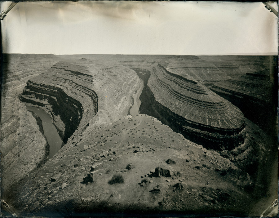
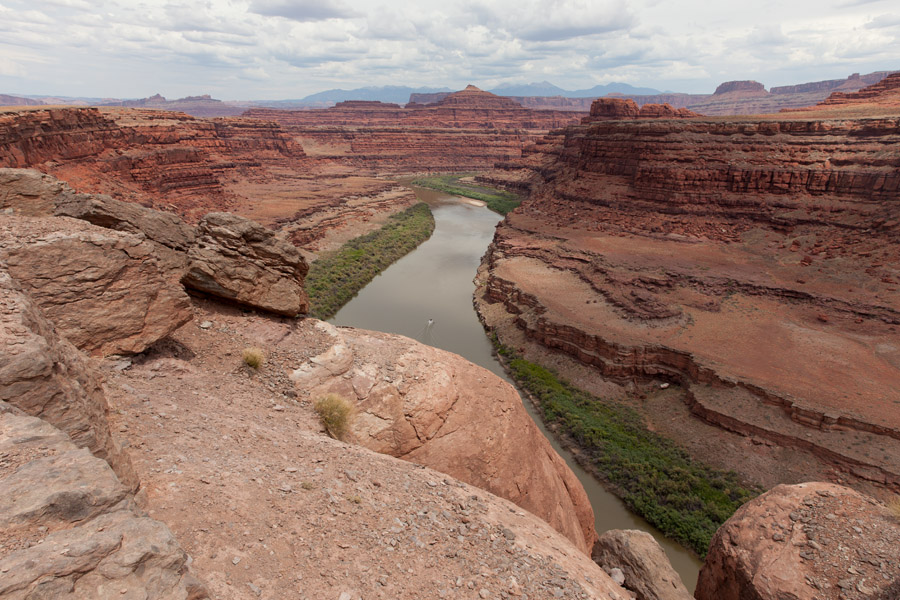
My first stop, since I knew it was a place I could camp if I rolled in late after dark – and was higher in elevation, hence hopefully cooler temps – was Goosenecks State Park. It’s small, as parks go, but the views are pretty stunning, and the campsites are spectacular.
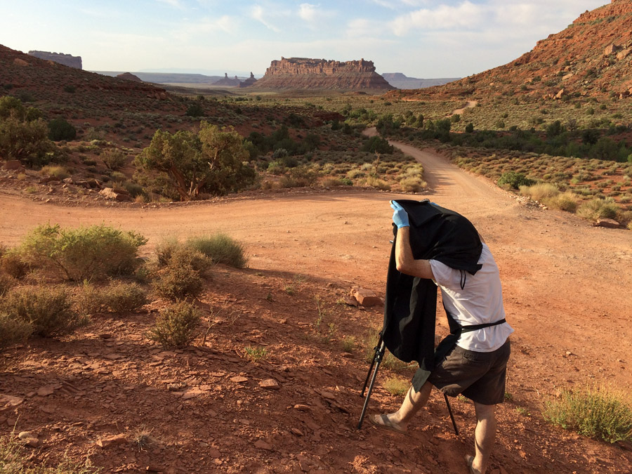
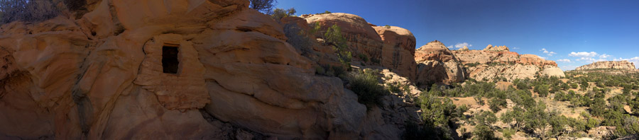
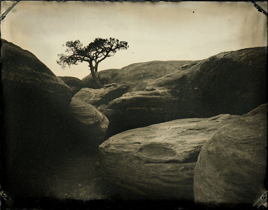
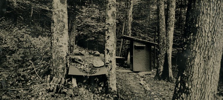
I had hoped to try out my new 65mm wide angle lens (for you DSLR photographers, 65mm is pretty wide on a 4×5 camera) to get more of the Goosenecks than I had on my previous visit. It still isn’t wide enough. Another part of the plan was to make a three-piece panorama, but for various reasons I’m still not thrilled with the results. Need more practice. In the course of making that panorama, though, I saw a different composition that I liked, so I went to plan C, and focused on making a few tins of that view (above).
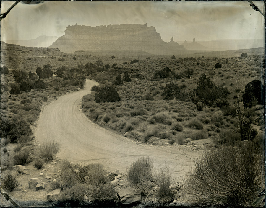
From the Goosenecks I went back into the Valley of the Gods, to get a second crack at making some photographs there. And this time, being early in the day, I was able to snag the sweet campsite right in the heart of the formations. Or maybe it’s because I was the only person crazy enough to be out there in July.
While the Goosenecks and Valley of the Gods are several thousand feet higher than the Phoenix valley, it was still pretty damn hot. So for my third night I thought I’d drive the Moki Dugway another 1200 feet higher up onto Cedar Mesa and camp out near Muley Point.
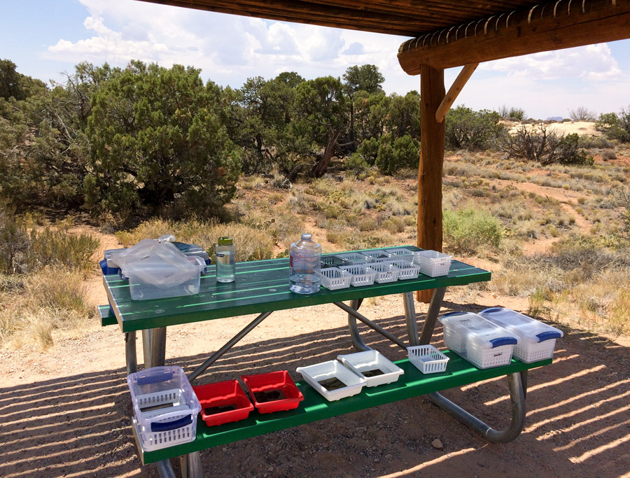
I didn’t make any tintypes up in the Muley Point area, but I did finally try out my custom-designed camp table, one of my recent projects at TechShop. I wanted something that was relatively easy to transport and simple to set up. The three parts are cut from plywood on TechShop’s ShopBot, a CNC wood mill.
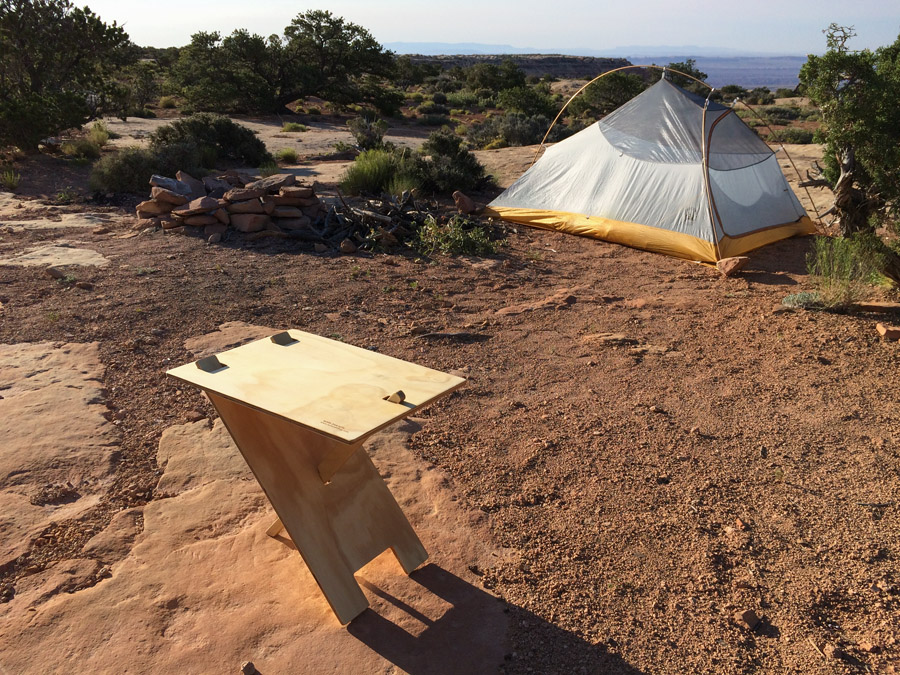
I set up the table and made the above photo, and was pretty happy with it. Then I got out my breakfast items to put the table to use…
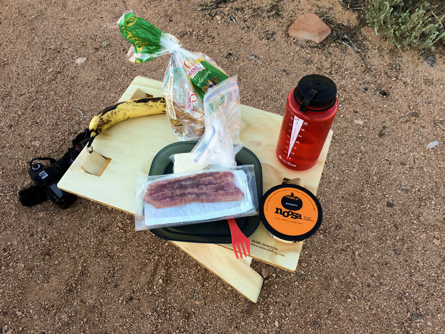
…at which point I discovered that if you put weight on the left-hand corners, the whole thing would tip over. (For example, in the photo above, if that red water bottle was on the left, everything would fall over into the sand.) Time for a re-design.
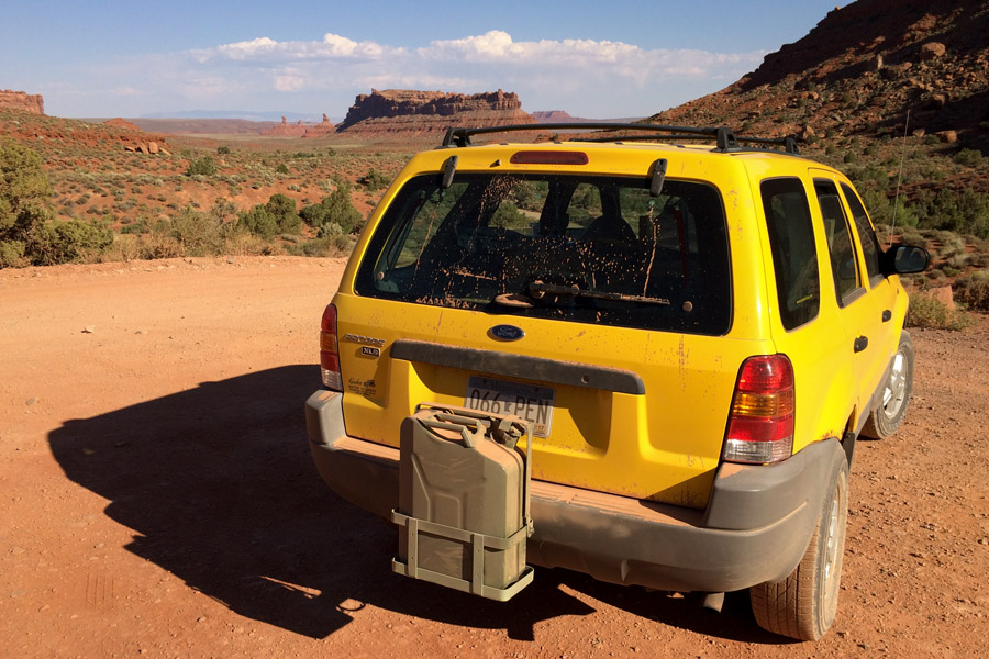
The first issue I had with Flora (the 17 year old car with 150,000 miles on it) was along the road out to John’s Canyon, at the base of Cedar Mesa. I stopped at one point to make some photographs, and being a steep spot, I pulled on the emergency brake…and kept pulling – the cable just snapped. No big deal, and as a friend pointed out, I could just put rocks under the wheels if necessary. (That idea will come back to haunt me in a bit.)
The next breakdown came a few days later, and was a bit more of a problem. Several miles off the main road I stopped to look at what I thought might have been some ancient rock art (turns out it was bird guano) and when I got back in Flora to continue driving, I couldn’t get the transmission out of Park. The shift lever just flopped around without doing anything.
Since it felt like a mechanical problem (rather than some electrical or computer issue) I took the cowling off the steering column and traced the linkages down from the stalk, through the firewall, and into the engine compartment. There I found two rods that looks like they should be connected, and, miraculously, I was able to pop them back together!
It was a stressful few minutes, since it was mid-afternoon, well over 100F, and no cell phone coverage. It wasn’t any kind of emergency – I had plenty of water, could make shade, and a paved road (and traffic) was only a few miles back – but it wasn’t all that fun either!
The next section of the trip was one of the main exciting portions for me. The plan was to really go off the grid, deep into the heart of what is now Bears Ears National Monument.
Interesting aside: I stopped in at a visitor’s information center in the area to chat with the helpful people there. The man that was on duty, when I mentioned going into Bears Ears, went off on a rant. I understand there are different points of view on what is happening with National Monuments such as this one, but while some of the things he said made sense, even if I disagreed, several of his points seemed a bit weird.

On the lighter side, and what started it, was his need to explain to me where the name came from – two cute wimpy little mesas that some people think look like the ears of a bear. Fair enough. For a region as vast and varied as this new monument, it is a somewhat modest edifice from which to derive the name.
On the more troubling side, though, and keep in mind this is the visitor center, an institution there to encourage and support tourism (and the resulting influx of tourism dollars to the local economy) the man complained that there has already been a 40% increase in visitors since Bears Ears was declared a National Monument. So…40% more people coming to the area, staying in their hotels, eating in their restaurants, filling up at their gas stations, and the visitor’s bureau thinks this is a bad thing.
Plenty of people, on both sides, don’t like the idea of increased visitation, like these public lands are their own private playground. Sure, if I’m going off into the wilderness, I don’t really want to see hordes of tourists either, but I am one of them, why am I special? More importantly, the more people who see and come to love these places, the more they will care about protecting them. It’s harder to pave over land you have camped on than some distant place you’ve never heard of.
Which brings me to another of the guy’s points: “the land is already protected! Why does it need more protection?” In many cases that is true, it was already protected in various ways, and I’ll admit I don’t know what changes, in practice, once it has been named a monument, but I’m pretty sure the protections don’t get weaker.
Then, the day after this conversation, I heard on the news that the Secretary of the Interior formally directed his minions to expedite permitting for drilling and mining on public lands – just because they are public lands, or that they are marginally protected, doesn’t mean they are off limits to activities that will harm them. The National Forest Service and the Bureau of Land Management are not there purely to protect nature – they exist to manage the resources in all ways, including cutting down trees, grazing the foliage, and mining the ground.
The guy, I assume, did have one very good point, no matter what side you’re on. He complained that while the monument was created to protect the lands, there wasn’t any money set aside for that protection, or any other useful development. I don’t know the veracity of that claim, but it certainly sounds plausible, and I can understand how people would be frustrated to get all of the attention the new designation causes, without any funding to support it.
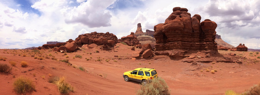
My friend Shane told me of a few places in the Beef Basin area that I should be able to get to with my car (and some, like Bobby’s Hole, that I should definitely avoid), so I loaded up on water, gas, and food, and took off.
The drive down into the Beef Basin area was pretty tame, by off-road standards, but was just challenging enough for me and Flora. It was perfect – I was some place I couldn’t get to with my car – and for the 48-hours I was in the area I saw only one other vehicle off in the distance.
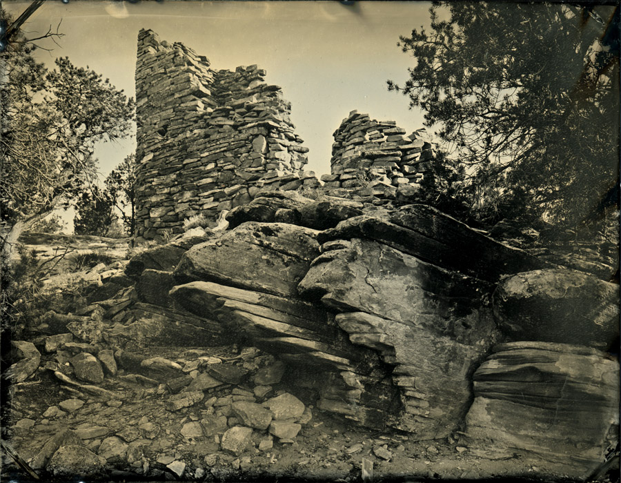
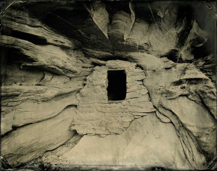
There are many ancient ruins spread around the valley. I picked two to photograph on this trip.
My friend said that I could photograph this one particularly spectacular ruin “from your car”, so I spent a little time exploring the area to find it. There it was, finally, high on a cliff. Sure you could photograph it from your car…with a telescope and a 50-ft ladder. (The closest you can get with a vehicle is in the far distance in the lower right corner of the photograph above.)
There were two steep sections to get to the ruin, and quite some distance, between where I could park and where I the camera needed to be. Rather than letting the plates dry out in the 8-10 minutes it would take me to scramble up and back, I decided to carry the darkbox part of the way (and up one of the steep sections). It’s ok, though, not like a couple of gallons of water and fixer are heaver or anything. And I waited until 5pm to start, so it was barely over 100!
Here’s the resulting tintype.
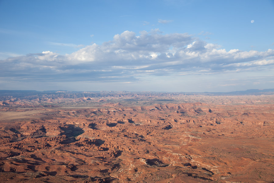
After climbing out of Beef Basin I passed through some civilization for gas and food, then headed back into the Needles District of Canyonlands National Park. I didn’t get too close to the actual Needles, but there was plenty to see and photograph even without getting off the beaten path. My biggest challenge here, aside from the heat, were a conspiracy of ravens that took a sudden interest in photography.
I was parked in one of the main tourist parking areas, and I’m sure the ravens were accustomed to easy pickings. And I saw them coming, so I prepared a little and put some things away, rolled up the front windows, etc. Wasn’t enough, though: I thought the 45 seconds or so that it would take me to run to the camera, make the exposure, and run back would be too short for the ravens to get into mischief, but I was wrong. First time I got back they had flown into the back of my car and tore a hole in my trash bag.
For the run to the next exposure I closed the trunk lid, with everything but a tray of fixer (on the ground, tucked way up under the muffler) safely inside the car. Came back to see my fixer running down the pavement. So after that I put absolutely everything inside the closed car for each exposure, which was a pain in the butt.
In my continuing quest to camp for free on NFS and BLM lands, I headed out of the park towards Hamburger Rock to find a campsite. Turns out Hamburger Rock is a campsite, and while lovely, cost $10 a night, and was surrounded by free camping areas. I frantically made a few tintypes before the sun went down, then made camp a quarter mile away.
At this point I decided to make a slight detour into Colorado to visit a couple of friends who have a summer home in the San Juan mountains.
I had a wonderful little visit, and enjoyed escaping the heat by getting higher into the mountains. Much higher. After I left my friends I drove over some back roads into Ouray, then up over an 11,000ft pass. And there, from the pass, a road wound seductively even higher. I had to see where it went!
I pulled Flora off the main highway and stopped at some signage about the route. One was a heavy steel sign that said “Four Wheel Drive and High Clearance Required”. About this time a guy came down the road, so I flagged him down and asked about conditions up there. He said it was rough, but he was confident I could make it. (He was driving a brand new Toyota 4Runner, and admitted it was his first time on roads like that, which should have been a warning.)
Well, I didn’t make it far before I got to a spot that Flora couldn’t easily get over. In order to have another go at it, I calmly put the car in reverse, backed up a bit, and hit the brakes. The car kept sliding backwards, and that freaked me out a bit. Once it stopped, I figured I’d better get out and make a plan, and I frantically scrambled around putting rocks under the wheels (remember the emergency brake is broken?) In my haste and adrenaline-fueled shakiness, I slipped and fell under the car, landing on several sharp rocks. (I still have bruises and sore spots on a finger and elbow as I type this, over a month later.)
Got rocks under the wheels so I had time to think about what to do (including, now, how to get the rocks out from under the wheels). Fortunately there was a spot just behind me that was, I thought, wide enough for me to make a gazillion-point turn. Unfortunately as I alternated between forward and reverse Flora would periodically stall. If this was on a “forward” section, facing the steep drop in front of me, the loss of power steering and power brakes freaked me out more, and by the time I was crosswise in the road (and blocking the two trucks that by this time were watching my flounder) my leg was shaking so hard that I couldn’t press the brake pedal, and I had to chill for a second.
I got out of there ok, obviously, and in hindsight it’s hard to see what the big deal was. My photos of the location certainly don’t look like anything frightening. Scared the crap out of me, though!
From Colorado I headed west back into Utah, back to the Needles Overlook into Canyonlands National Park.
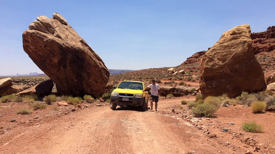
I looped through Moab for gas and food. Stopped in the BLM office for information and suggestions on what route to take, and the very helpful person there told me about the Potash Road and the Shafer Trail.
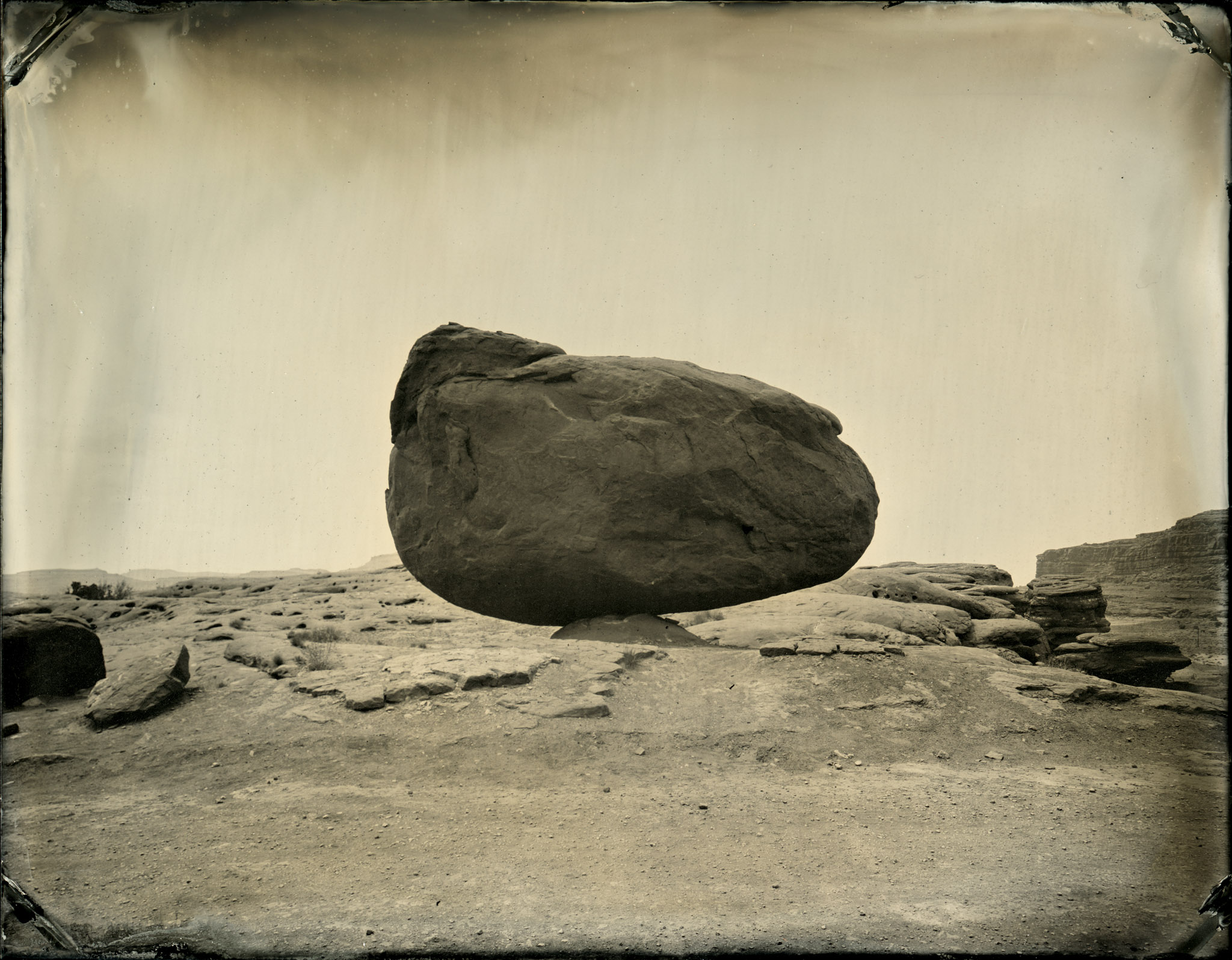
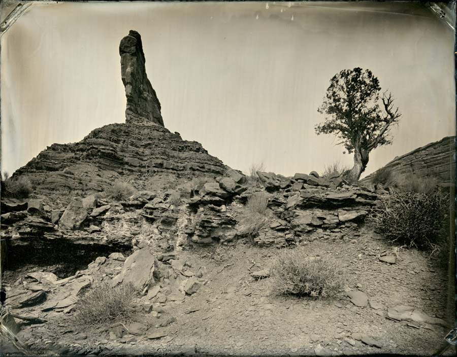
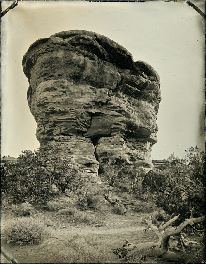
The Potash Road has some fantastic scenery, most of which I drove by, scribbling notes to myself on where to return on the next trip. Despite being mid-day, and around 105F, I couldn’t pass up making tintypes of one particular balanced rock (first photo in this post).
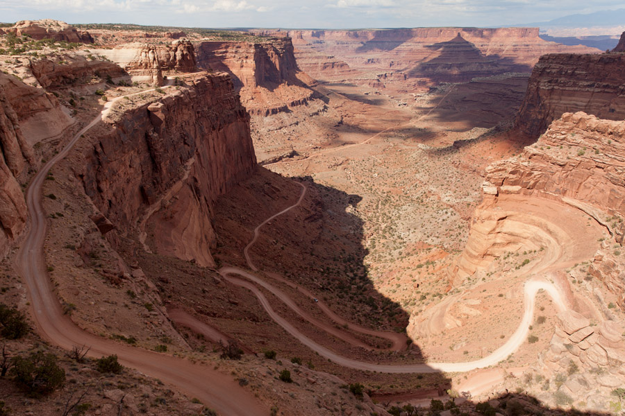
I was a little nervous, after my experience back in Colorado, to drive up the steep switchbacks of the Shafer Trail, but wow was it worth it.
I make a quick tour through the Island in the Sky district of Canyonlands, and while I didn’t make any tintypes, it was still a good visit.
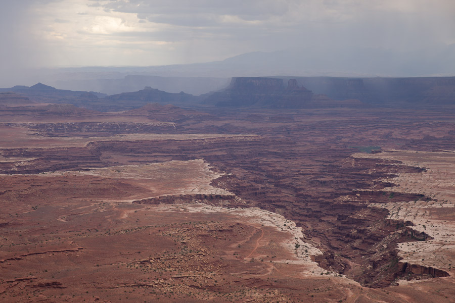
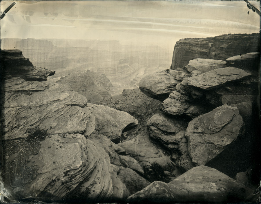
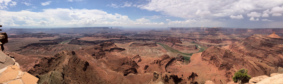
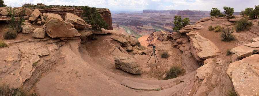
While I was in the area I stopped in Deadhorse Point State Park and made a few tintypes from there.
In the interest of saving some time I didn’t backtrack to Moab for groceries, and instead stopped in Green River, Utah. Whoops. Anyhow, I went down to Hanksville to stay in a hotel that I like there, and get cleaned up and restocked for the next leg out into Glen Canyon and Grand Staircase-Escalante.
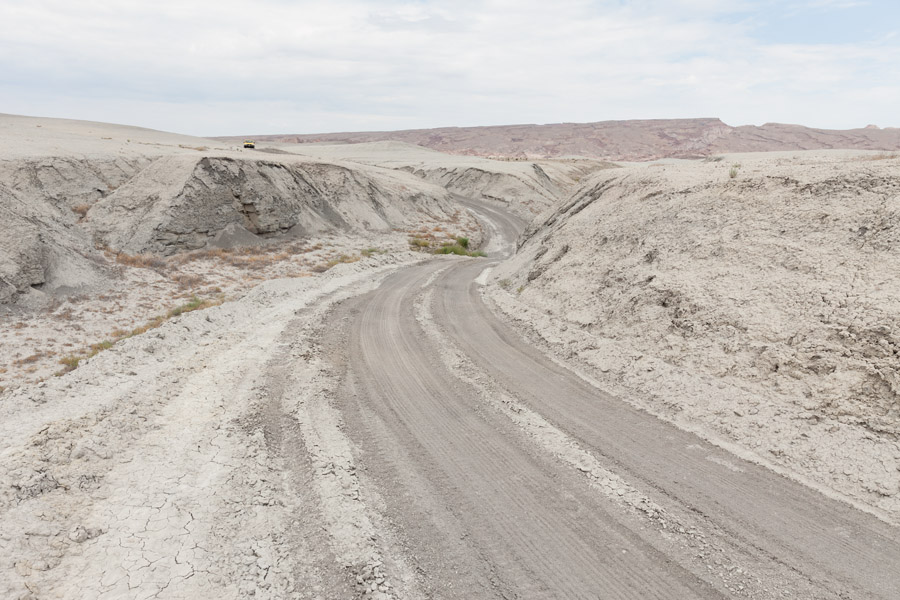
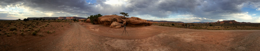
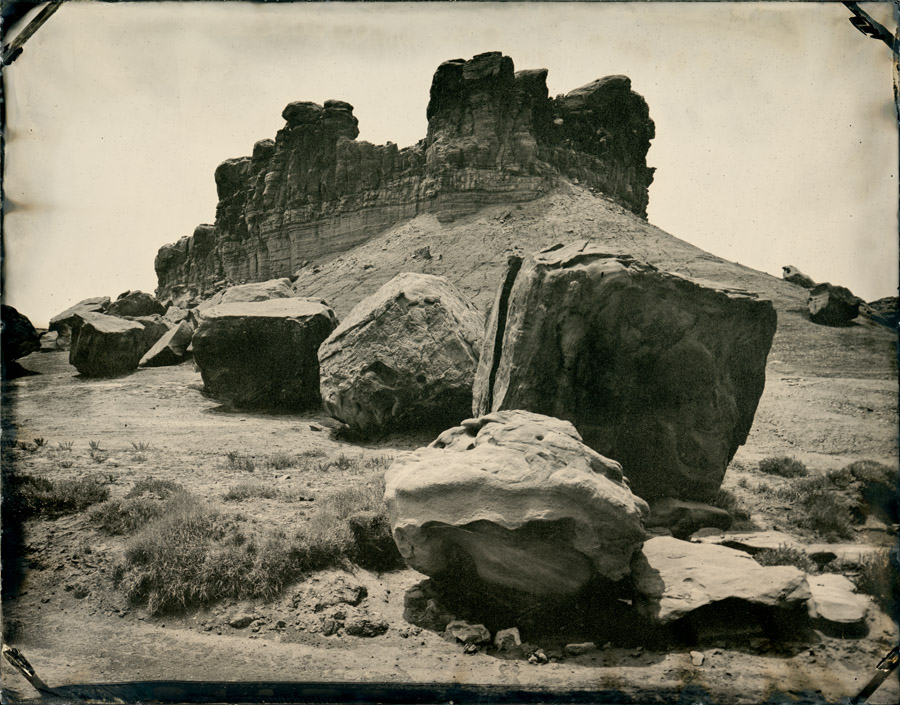
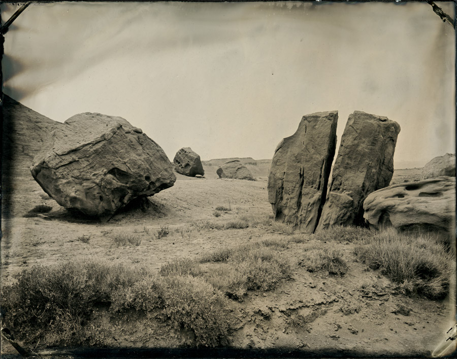
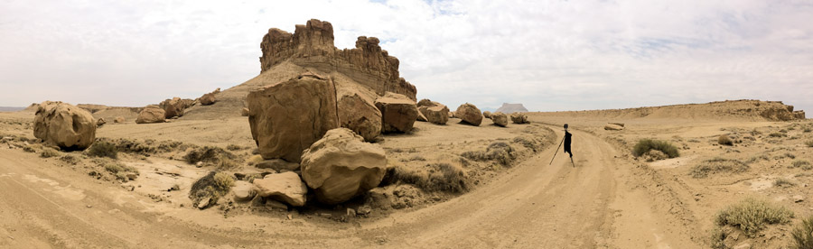
The next morning I woke up and headed out past Factory Butte to see what was out there, and spent a couple of hours making tintypes of some cool boulders.
When I got back to cell phone range, I had a voicemail from the nursing home where my mother was living. The nurse said that mom wasn’t doing well, and that I should call. After returning her call, and making several others to friends and relatives, started to make my way to Ohio, by way of a brief stop home in Tempe to switch travel modes. I made it as far as Flagstaff, where I got the call that mom had passed.
The Great Tintype Adventure of 2017 didn’t end as I had planned, but since I’m still hooked on southern Utah’s scenery, I’m hoping that my travels in July become Part 1 of 2…with Part 2 happening in cooler months.
Pingback: The Nomadic Frog Blog » Archive » Great Tintype Adventure of 2017 (Part 3)